_____________________________________________________________________________
“New World” Beginnings
Section 1, Lesson 1
Previous Lesson:
Next Lesson: Influences on European Exploration

This map shows the coastline of South America, the Caribbean and Antarctica.
Piri Reis (1465 or 1470-1554 or 1555) World Map of 1513 courtesy of Wikimedia Commons. This map shows the coastline of South America, the Caribbean and Antarctica.

Anywhere from 14,000-72,000 years ago, Asians came to the Americas…
Image courtesy historyofamerica.info

…probably in the area of the Bering Strait.
Image courtesy of the United States Geological Society.

There is evidence that as many as 16 other visits between the Americas and other continents…
Abraham Ortelius (1527-1598) World Map of 1570 courtesy of Wikimedia Commons.

…occurred before Christopher Columbus arrived in 1492.
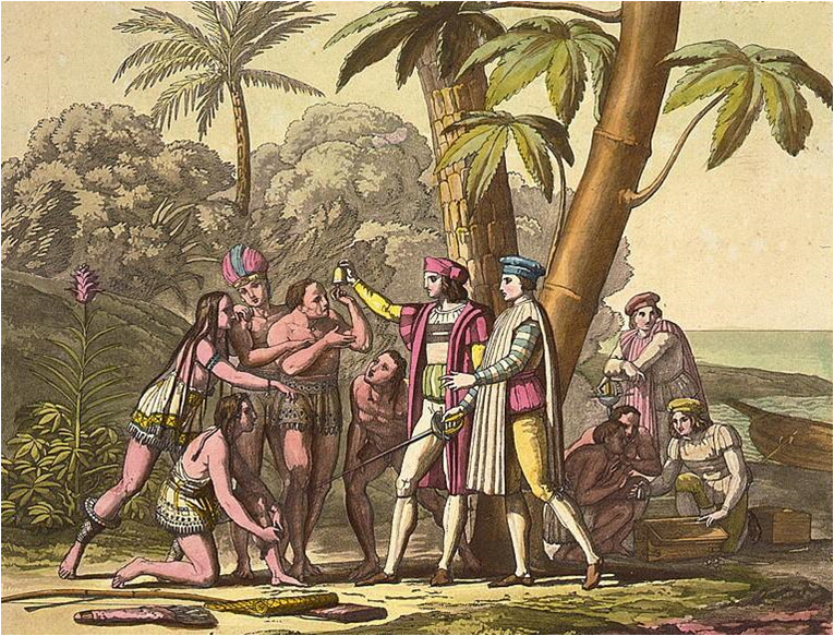
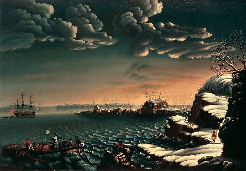
Landing of Columbus by John Vanderlyn. Oil on canvas, 1846. This painting was placed in the rotunda of the United States Capitol in 1847. Image courtesy of the Architect of the Capitol.
Some evidence for these visits/migrations is stronger than others.
Norwegian silver penny minted between 1065 and 1080 A.D./C.E. Found in Maine. This image is courtesy of the Maine State Museum.

Some of the moderate to strong evidence includes:
The Skalholt Map of Greenland by Biorn Jonsen 1669 in which he attempts to combine cartographic knowledge with stories conveyed int he Vinland Sagas. Image courtesy of Det Kongelige Bibliotek.

It is believed that between 3500 and 8000 years ago, Indonesians and South Americans were familiar with each other because…
This image circa 2011 is courtesy of Google.com.

… There are similarities in blow guns, paper making, and other crafts.
This image circa 1900-1940 is courtesy of the Tropenmuseum of the Royal Tropical Institute (KIT).

It is believed that approximately 7000 years ago the Japanese visited Ecuador because…
This 2011 image courtesy of Google.com

… They have similar pottery and fishing styles.
Japanese pottery from the Joman period (10,000 BC to 300 BC). Similar pottery has been found in the Valdivia culture of Ecuador. Image courtesy of Suntory Museum.

It is believed that approximately 2600 to 12,000 years ago the Crees from Siberia visited/migrated to New Mexico because…
This 2011 image courtesy of Google.com

… the Navajos in New Mexico are genetically different from other Native American groups in the U.S. and culturally resemble the Crees.
Cree Camp in Alberta Canada circa 1871. This image is courtesy of Wikimedia Commons.

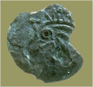
It is believed that approximately 2300 to 3000 years ago, Phoenicians from North Africa visited Central America because…
This 2011 image courtesy of Google.com
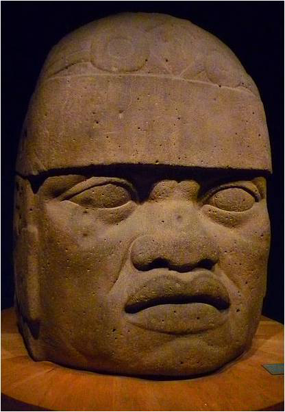
…there are Negroid and Caucasoid likenesses in sculpture and ceramics, and some Arab history in Central America writings. (However, claims of pre-Columbian contacts with Africa are rejected by the vast majority of archeologists and other Mesoamerican scholars).
One of the Colossal Heads of Olmec found in south-central Mexico. This one might have African features. It was made approximately 2500 years ago. This image is courtesy of Wikimedia Commons.
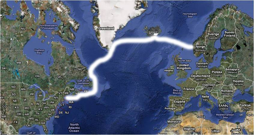
Approximately 650 to 1000 years ago, Vikings or Norsemen from Scandinavia explored what is now Canada and possibly New England.
This 2011 image courtesy of Google.com

Their explorations would take them to Iceland, Greenland, and eventually to what is now Canada.
Leif Ericson Discovering America by Christian Krogh (1852-1925). It was painted in 1893. This image is courtesy of Wikimedia Commons.

Over time their settlements were abandoned and their discoveries were forgotten.
Recreated Norse Log House at L’Anse aux Meadows, Newfoundland and Labrador, Canada. This photograph was taken by D. Gordon E. Robertson and is courtesy of Wikimedia Commons.

We have word of these visits passed down in oral stories, and songs. We also have archaelogical evidence.
A copper alloy ring headed pin of Norse design. Found at L’Anse aux Meadows. Greatly magnified. Pins such as these were used to close the outer garments of both men and women. This image is courtesy of the University of Pittsburgh.
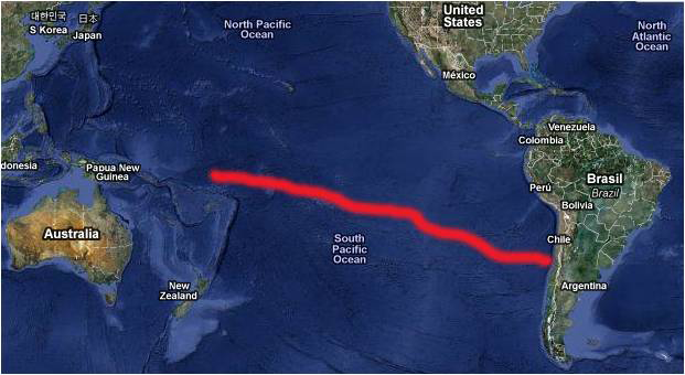
It is believed that approximately 600 to 700 years ago, Polynesians visited Chile because…
This 2011 image courtesy of Google.com
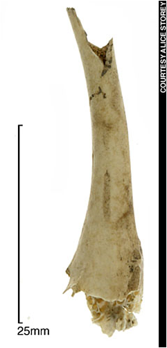
…there are chicken bones with the DNA of Polynesian chickens before the Spanish arrived and similar fishhooks.
Chicken bone discovered in Chile with DNA matching Polynesian chickens. Image courtesy of Archaeological Institute of America.

It is believed that 650 to 700 years ago West Africans visited Central America, South America, and the Caribbean because of …
This 2011 image courtesy of Google.com

…Portugese sources in West Africa, stories from natives in Haiti to Columbus, and stories from natives in Panama to the Spanish explorer Balboa.
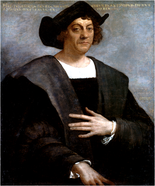
“Modern” American history begins approximately 500 hundred years ago, when the American continents were “discovered” by Columbus.
This portrait of Christopher Columbus was painted in 1519 by Sebastiano del Piombo. It is courtesy of Wikimedia Commons.
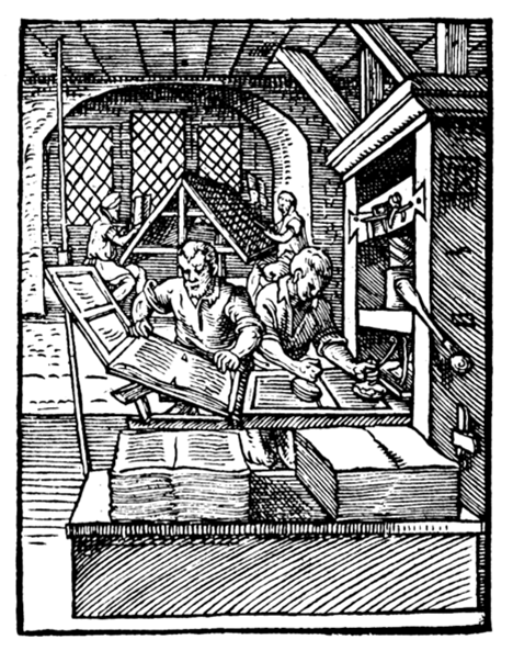
Increased European literacy and the printing press allowed news of Columbus’ journey to spread much faster than those who came to the Americas before him.
At left in the foreground, a printer removes a printed page from the press. The printer at right is inking the plate. In the background, compositors are using cast type. This image produced in 1568 is courtesy of Wikimedia Commons.
Therefore, in some people’s minds, Columbus receives the credit for “discovering” the Americas which were already populated.

North and South America eventually were the home of many countries.
The most influential country in the Americas was the United States.
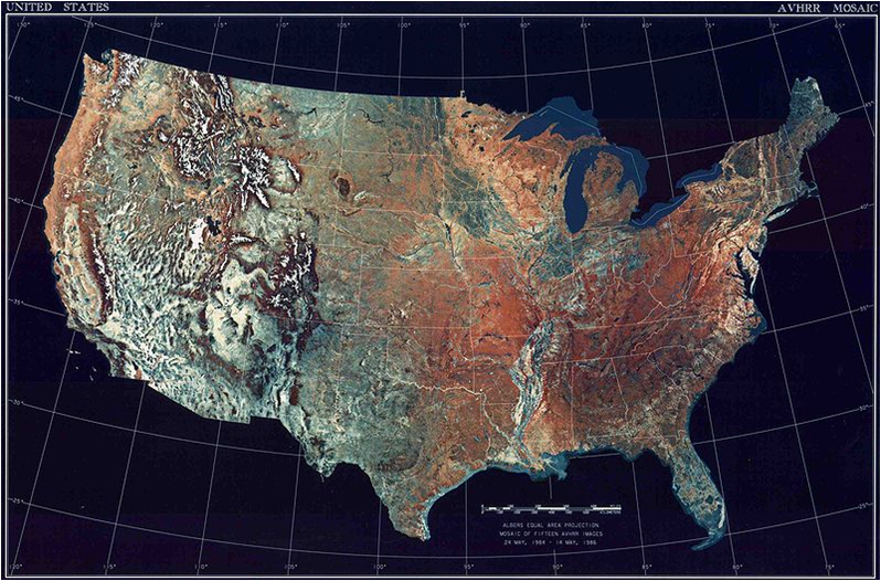
This February 5, 2008 satellite image of the 48 contiguous states of the United States is courtesy of the National Climactic Data Center/NOAA Satellite and Information Service.

It influenced other parts of the world with its:

A. Humanitarian goals…

B. …democratic ideas…
C. …aid for the mistreated and for the poor of other lands…
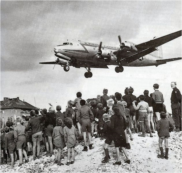
Berliners watching an American C-54 cargo plane bringing food and other supplies land at Berlin Tempelhof Airport, 1948. This image is courtesy of Wikimedia Commons.

D. … its economic might…
This image is courtesy of usa-economy.
E. …and its military strength.
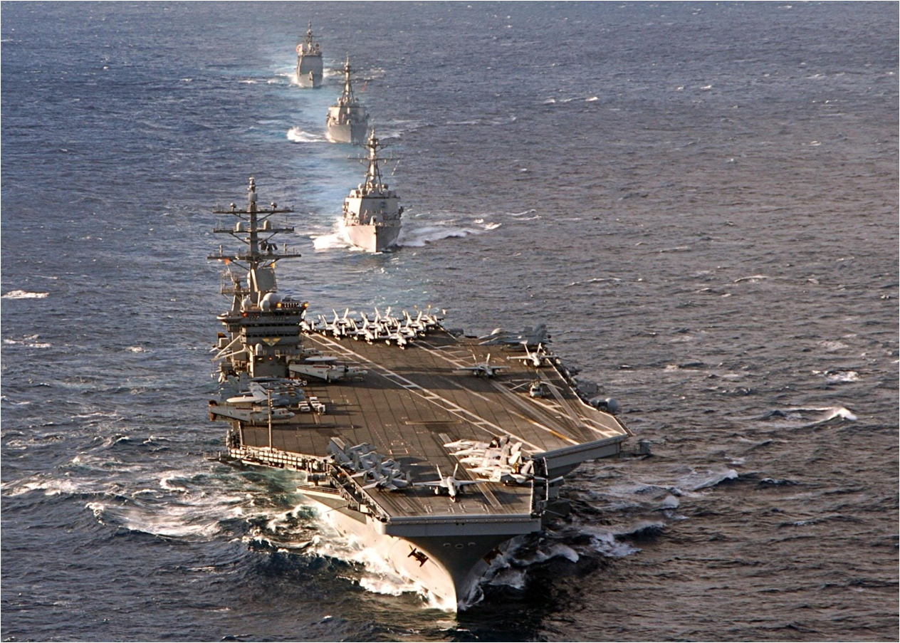
The Nimitz-class aircraft carrier USS Dwight D.Eisenhower and other members of its carrier group sail in formation during training on March 5, 2006. This U.S. Navy photo by Photographer’s Mate 2nd Class Angel Contreras is courtesy of the United States Navy.

Before the Europeans arrived, the Americas were vast lands…
This photograph of the Great Smoky Mountains National Park was taken at 7:50 PM EST on April 7, 2007 at the Cliff Tops on Mount Le Conte. It is courtesy of Wikimedia Commons.
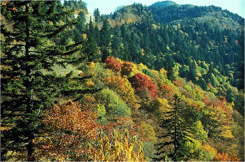
…with untapped resources.
The forest canopy at Newfound Gap in the Great Smoky Mountains. The trees in the foreground are deciduous trees or hardwoods and their leaves are changing colors in the fall. The trees in the higher elevation are conifers (Red Spruce and Fraser Fir) which can grow better than the hardwoods in colder climates. This image is courtesy of the National Park Service.
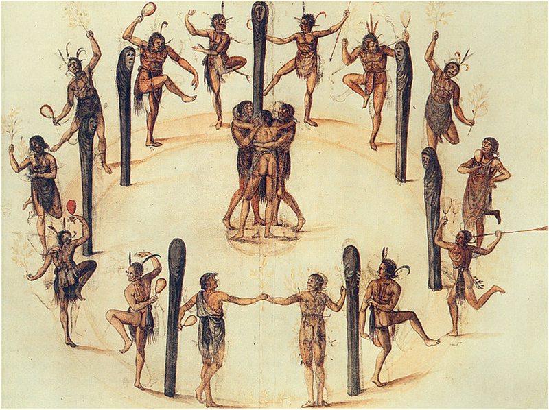
The native inhabitants, although numbering in the millions, thinly covered the land.
Dancing Secotan Indians in North Carolina. This was water color was painted by John White in 1584. It is courtesy of the British Museum, London, England.
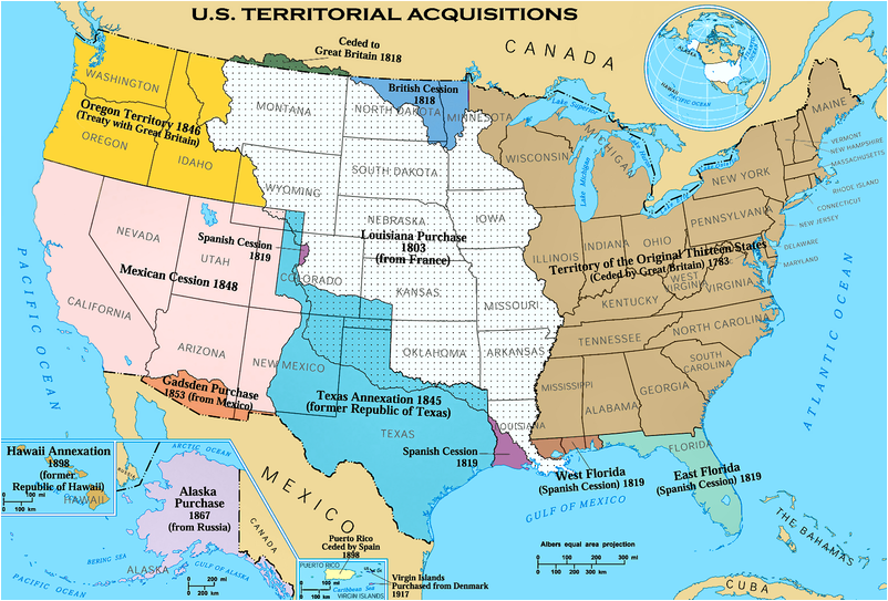
The country that would become the United States of America…
Territorial Acquisitons of the United States. This image is from the National Atlas of the United States, and was produced by the United States Federal Government.
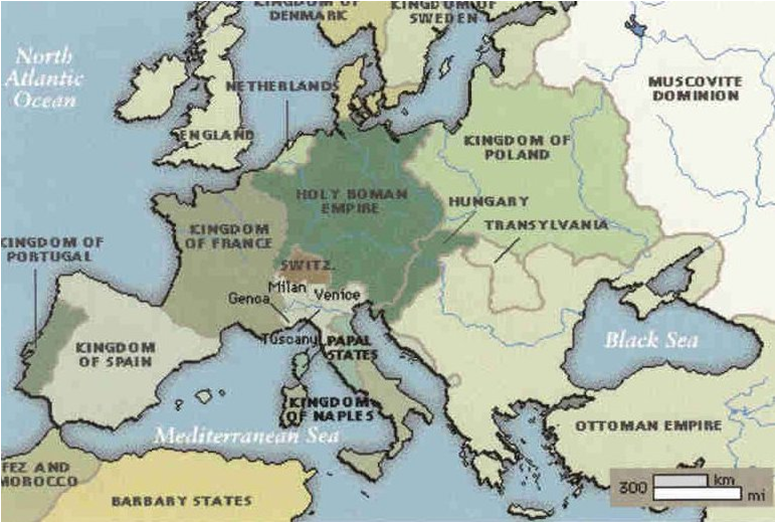
…was first and foremost a product of Europe.
This map of Europe 1500-1700 is courtesy of Ancestry.com
______________________________________________________________________________
Influences on European Exploration
Section 1, Lesson 2
Previous Lesson: “New World” Beginnings
Next Lesson: The Portuguese
Influences on European Exploration.
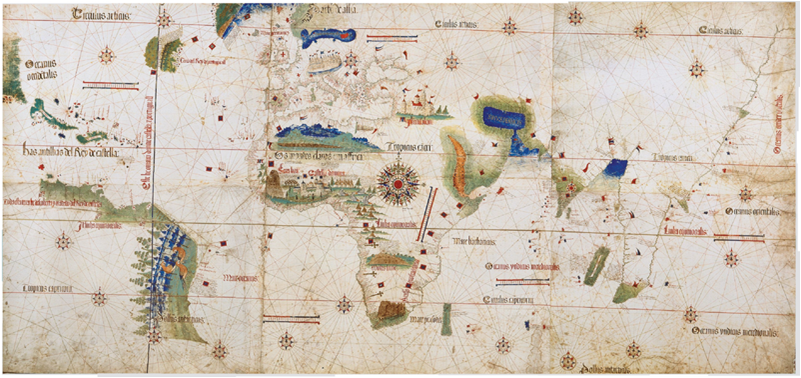
The Cantino World Map has been called by some the most important manuscript map surviving from the Age of Discovery. It is anmed for Alberto Cantino, an Italian diplomatic agent in Lisbon, Portugal, who obtained it in 1502. It was covertly copied without authorization from the Portugese government. It incorporated what were then extensive, new, geographical information based on voyages of four explorers: Columbus to the Caribbean, Pedro Alvarez Cabral to Brazil, Vasco da Game to Africa and India, and the Corte-Real brothers to Greenland and Newfoundland. Except for Columbus, all had sailed for Portugal. This image is courtesy of Wikimedia Commons.

Two events were very influential in stimulating European exploration:
A Portugese ship in Nagasaki, Japan circa 1600. This image is attributed to Kano Naizen (1570-1616) and is courtesy of Wikimedia Commons.

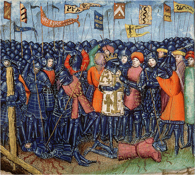
First, the Christian “Crusades” from approximately 1000-1300 motivated Europeans to explore other lands.
This painting, by Jean Fouquet (1420-1481) titled, “Arrival of the Crusaders at Constantinople,” shows an event from the Princes’ Crusade. Here French Crusaders arrived outside the walls of Constantinople between November 1096 and April 1097. Image courtesy of Wikimedia Commons.

During the Crusades, thousands of Europeans invaded the Middle East’s Palestine…
This map depicts Europe in 1142. Palestine is the light blue area in the bottom right. A blow up of Palestine is in the top left of This image. Image courtesy of Wikimedia Commons.

…in order to save the Christian “Holy Land” from the Muslim “infidels.”
Capture of Jerusalem during the First Crusade, 1099, from a medieval manuscript. This image is courtesy of Wikimedia Commons.

Oh, and if they came away with a lot more riches from the Middle East, that would be very satisfactory.
This coin, a silver denier (a denier was roughly the French equivalent of the penny) depicts one of the Crusader Kings of Antioch, King Bohemond III (1162-1201 A.D.) On the left is a helmeted head of the king in chain-maille armor. There is also a crescent and star on each side of the king. On the right is a cross, symbol of the Christian Crusaders. This image is courtesy of ancientresource.com.

The Middle East is a crossroads between Europe and Asia.
2011 image courtesy of Google.com.
Although the European “barbarians” were eventually defeated in their adventures…
At the Battle of Hattin, in what is now Israel, Muslim forces under Saladin captured or killed the majority of the European Crusader army. After this Second Crusade battle, which took place on July 4, 1187, Islamic forces again became the preeminent military power in the Holy Land. However, other Crusades would still follow. This painting, from an anonymous 15th century artist, is courtesy of Wikimedia Commons.

…their exposure to Asian culture drove them to acquire goods and materials from that region.
Knights Templar playing chess, a game that was invented in India. Circa CE. This image, circa 1283 was created by Alphonse le Sage. It is courtesy of Wikimedia Commons.
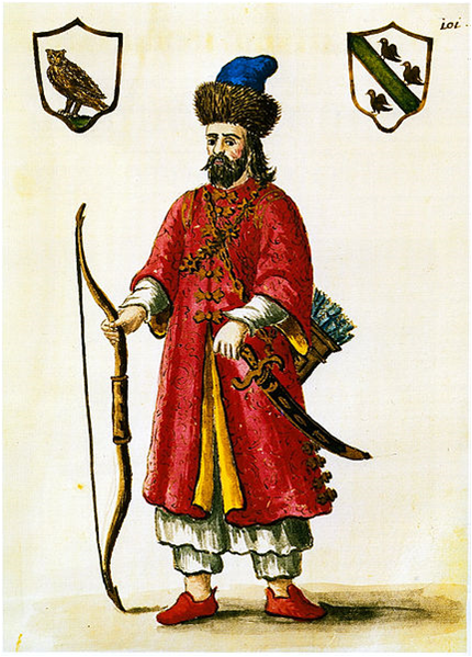
A second reason for Europeans to be motivated to trade with Asia was when an Italian adventurer, Marco Polo…
Marco Polo (c. 1254-1324) in a costume worn by the Mongolian Tartars. This image by Grevembrock was created on an unknown date. It is courtesy of Wikimedia Commons.
…wrote an account of the 24 years he had spent in China, a land he described as having many riches.
A page from one of the versions of Marco Polo’s description of his life in Asia, Il Milione. This book helped to introduce Europeans to Central Asia and China. This page, produced between 1298-1299 is courtesy of Wikimedia Commons.
Marco Polo’s account of his stay in China was widely published and “embellished” throughout Europe.
A miniature from the book “The Travels of Marco Polo” or Il Milione. The book was originally published during Polo’s lifetime (1254-1324) but was frequently reprinted and translated. This image is courtesy of Wikimedia Commons.

Some of the goods that Europeans wanted from Asia included:
Cloud-patterned silk from the Tomb No. 1 at Mawangdui, Changsha, Hunan province, China. It is from the Western Han Dynasty (202 B.C.E.-9 C.E. ) This photograph by drs2biz is courtesy of Wikimedia Commons.

A. Spices to help spoiled and boring food…
Spices in Mapusa Market, Goa, India. This image by judepics is courtesy of Wikimedia Commons.

B. …silk and other cloths to softly cover their bodies…
A Viking combining oriental features with Nordic styles. This photo is by Annika Larsson.

C. …drugs for painful parts of their bodies
This image of raw opium is courtesy of Wikimedia Commons.

D. …perfumes for bodies that infrequently took baths…
Chinese bottles from the Spinnaker Collection. These bottles date from the Qing Dynasty (1644-1912). This image is by the Crow Collection of Asian Art.

E. …colorful cloths to decorate the inside of their dwellings…
Flower-patterned silk from Tomb No. 1 at Mawangdui, Changsha, Hunan province, China. It was made during the Western Han Dynasty (202 B.C.E.-9 C.E. ) This image by drs2biz is courtesy of Wikimedia Commons.

F. …ivory, gold, jewels, and other treasures said to be in abundance in Asia.
A Chinese gold bowl. This image is courtesy of worldtrade.com.
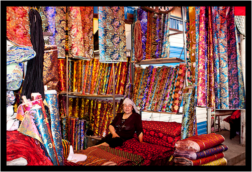
However, the luxuries of the “Far East” were very expensive in Europe:
This image of a Kashgar, China Sunday Market is courtesy of airtreks.com.

The reasons that Asian goods were expensive included:
This Goldfish Vase was made of porcelain during the reign of the Jiajing Emperor (1521-1567). This image by Vassil is courtesy ofWikimedia Commons.

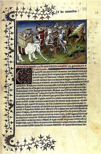
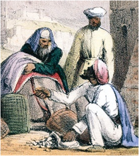
A. Asian goods had to be transported mostly overland long distances from China and India, many times by camel…
This drawing from the Catalan Atlas of 1375 depicts a caravan. It is courtesy of Wikimedia Commons.
A. (cont.) …to ports in the eastern Mediterranean, such as in Italy…
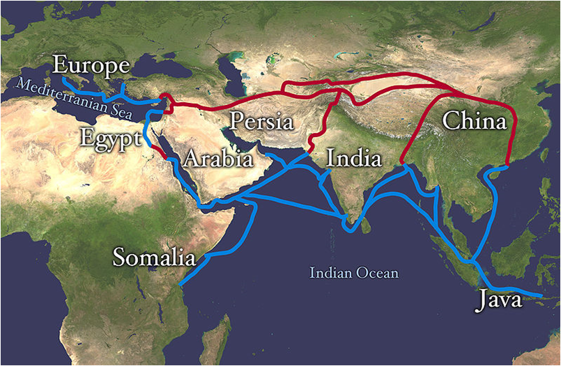
There were a variety of trading routes between Asia and Europe. Red lines show land routes. Blue lines show sea/water routes. This image is courtesy of Wikimedia Commons.
B. …Arab and Persian “middle men” placed a heavy toll/tax on the goods traveling across their lands from Asia to Europe…
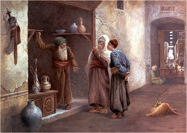
This painting is titled, Arab Traders, Cairo. It was produced by Charles Robertson in 1875. This image is courtesy of artnet.com.

C. By the time the goods reached Italian ports such as Genoa or Venice…
A woodcut of Genoa, Italy in 1493 from the Nuremberg Chronicle. This image is courtesy of Wikimedia Commons.
C. (cont.) …they were so expensive only a few people could afford them…
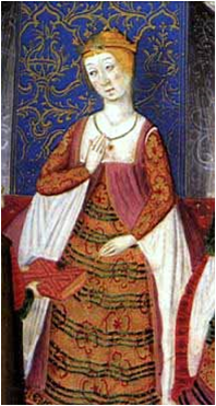
Isabella of Castille, Spain in 1482. She was the Queen of Spain. This image is courtesy of Wikimedia Commons.
D. There was an added cost to ship the goods from the Italian port cities to the rest of Western Europe.
2011 image courtesy of Google.com.

E. …The profits for the businessmen selling the goods was too small to inspire them to consistently import these articles.
The public plaza in Siena, Italy. This frescoe by Ambrogio Lorenzetti (1285-1348) titled The Allegory of Good Government was painted during the early 1300s.

Buyers and merchants in Western Europe were anxious to find a less costly route to the riches of Asia…
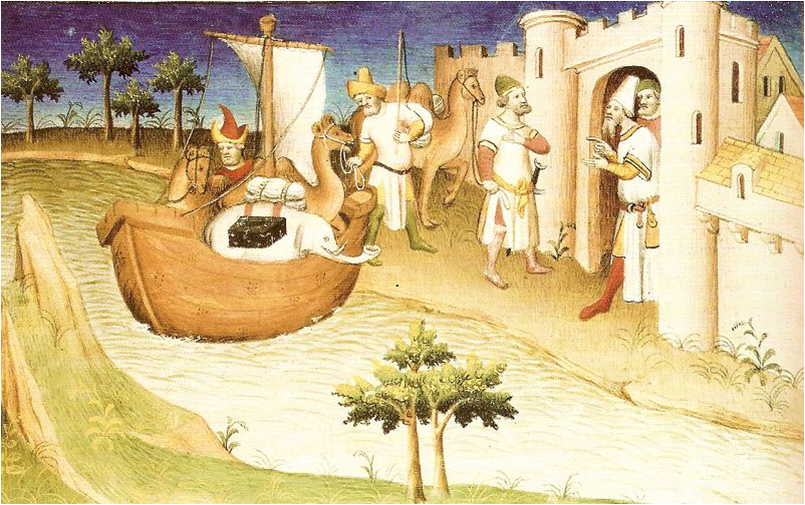
Camels with carriages on top known as a howdah. In Persia (Iran) camels frequently carried a howdah. In India elephants would carry a howdah. This image was painted in 1855 by Emile Rouergue and is courtesy of Wikimedia Commons.
…and they wanted to avoid paying the Arab and Italian “middle men.”
Arab traders using cowry shells as money. This 1845 image is courtesy of Saudiaramcoworld.com.

The Renaissance (rebirth), which was a cultural movement, began in Europe in the 1300s and lasted until the 1600s.
The Adoration of the Lamb was painted in 1432 by Jan van Eyck (1395-1441). It is located in the Cathedral of Saint Bavo in Ghent, Belgium. This image is courtesy of Wikimedia Commons.
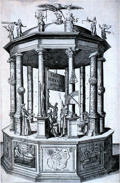
The Renaissance affected, among other ideas: architecture, philosophy, politics, science, and religion.
Frontispiece of the book, Rudolphine Tables by the astronomer Johannes Kepler (1571-1630). This image is courtesy of Wikimedia Commons.
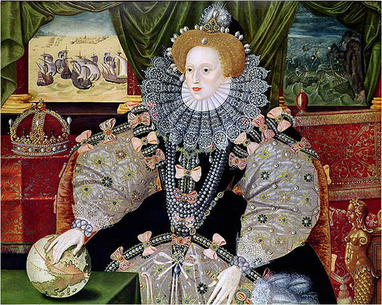
The Renaissance created a spirit of optimism, self-reliance, and a desire to explore and have adventures.
Queen Elizabeth I of England is shown in this circa 1588 portrait to commemorate the defeat of the Spanish Armada. This image courtesy of Wikimedia Commons.

During the Renaissance the following technological advances allowed European exploration to increase:
An expedition’s shipwrights constructing a ship in 1541. This small ship would be used in searching for food. This image is courtesy ofWikimedia Commons.
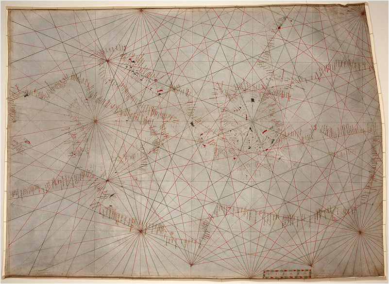
A. Better maps were produced which reduced irrational fears of previously unknown lands…
This nautical chart covers the Mediterranean Sea and the western part of the Black Sea. It was produced circa 1320-1350 C.E. possibly by a cartographer in Genoa, Italy. This image is courtesy of Wikimedia Commons.

B. …Compasses, invented in China, eased some of the risky aspects of a voyage.
A Bearing Compass from the 1700s. The invention of the compass enabled the determination of heading when the sky was overcast or foggy. When the sun or other known celestial bodies could be observed, it enabled the calculation of latitude. This enabled mariners to navigate safely far from land and increased sea trade. This image is courtesy of Wikimedia Commons.

C. …Printing Presses advanced scientific learning and information to more people…
A printer operating an early Gutenberg letter press (this version is a screw press) in the 1400s. This image is courtesy of Wikimedia Commons.

D. … Better ships were built that could travel faster, farther distances, and eventually hold more goods.
A replica of one of Ferdinand Magellan’s ships, Victoria. Magellan led the first expedition that cirumnavigated the world. (1519-1522). This image by Gnsin is courtesy of Wikimedia Commons.
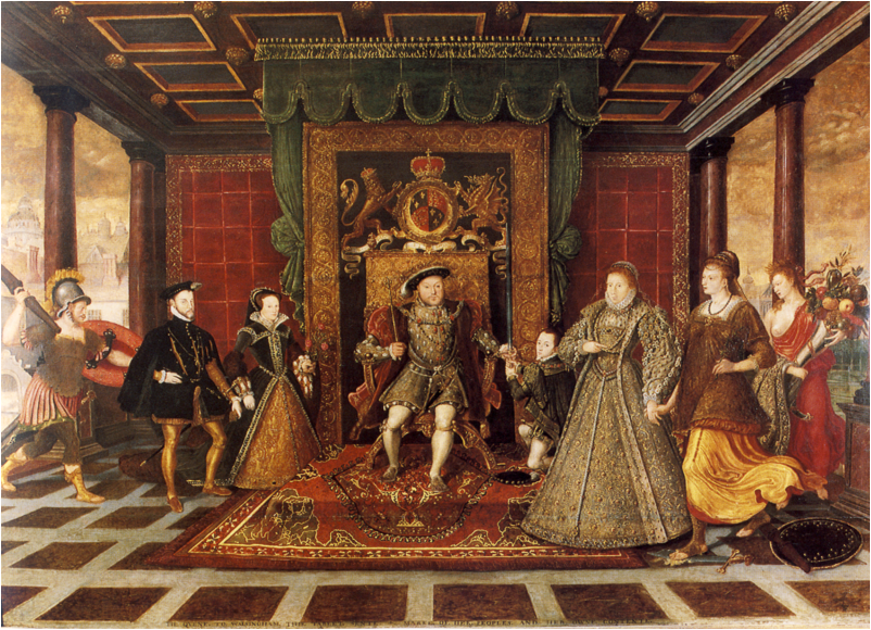
Politically, the Renaissance was important to Europe because modern nations began to emerge.
This image is a detail from the painting Allegory of the Tudar Dynasty. It is attributed to Lucas de Heere. The monarchs from left to right include Phillip II of Spain, Queen Mary I of England, King Henry VIII of England, King Edward VI of England, and Queen Elizabeth of England. It was painted circa 1572 and is courtesy of Wikimedia Commons.

Previously nobles controlled their own small areas or fiefdoms.
Depiction of a fiefdom in Brevarium Grimani. This scene depicts June. It was created circa 1510 and is courtesy of Wikimedia Commons.

In the Renaissance, the nobles and their lands came under the control of a king who controlled the new nation.
Ratification of the Treaty of Munster between Spain and the Dutch Republic in the town hall of Munster, May 15, 1648. This treaty resulted from the first modern diplomatic congress, thereby initiating a new political order in central Europe, based upon the concept of a sovereign state governed by a sovereign. This image was painted circa 1648 -1670 and is courtesy of Wikimedia Commons.

These new nations had the power to take on the tasks of exploring…
A replica of English explorer John Cabot’s ship The Matthew. It was photographed in Bristol, England Harbor on August 2, 2004 by Chris McKenna. It is courtesy of Wikimedia Commons.

…invading…
French explorer Samuel de Champlain arriving at the future site of the city of Quebec in 1608. This image was painted circa 1909 by George Agnew Reid and is courtesy of Wikimedia Commons.
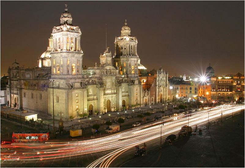
… and establishing colonies.
The Mexico City Metropolitan Cathedral of the Assumption of Mary is a legacy of the Spanish settlement in Mexico. It was constructed in sections from 1573-1813 around the original church that was constructed soon oafter the Spanish conquest of Tenochtitlan. This image is courtesy of Wikimedia Commons.
The first European nations to unite were the first to become colonial empire builders.
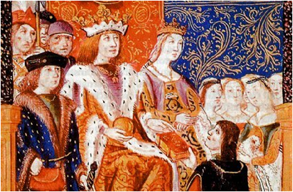
In 1469 the crowns of the Spanish Christian kingdoms of Castile and Aragon were united by the marriage of Ferdinand II of Aragon and Isabella I of Castile. By 1492 the combined forces of Castile and Aragon captured the Arab Emirate of Granada ending the last remnant of a 781 year presence of Islamic rule on the Iberian Peninsula. Once Spain was united, it would fund explorations and colonies. This image is courtesy of Wikimedia Commons.
They included Portugal, Spain, England, France, and the Netherlands.
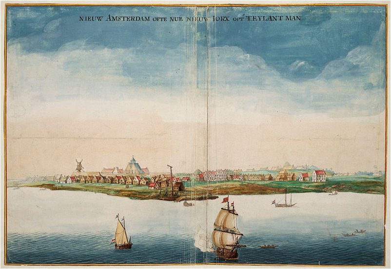
New Amsterdam was founded by the Dutch in 1625. This image shows the area in 1664 when it was conquered by the English and renamed New York. This image, painted circa 1664 by Johannes Vingsboons is courtesy of Wikimedia Commons.
_
_______________________________________________________________________________
The Pequot War
Section 2, Lesson 8
Previous Lesson: Connecticut & New Hampshire
Next Lesson: King Philip’s War

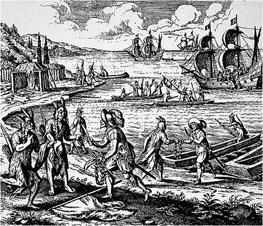
When the Europeans arrived, the Indians nations had a choice of which European nation that they wanted to trade with and become allies.
This image known as "Captain Goswold Trades with the Indians" is probably Bristol, England merchant John Guy trading with Native Americans in Newfoundland in 1612. This image was created circa 1634 by Johann Theodore DeBry. It is courtesy of the Virginia Historical Society.
The Pequot War (1634-1638)
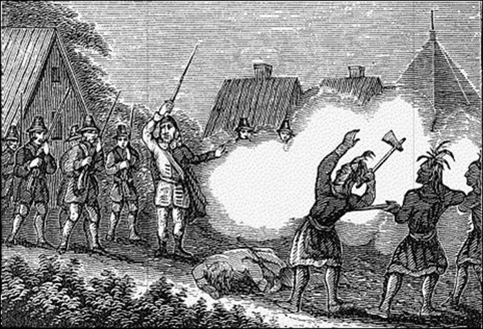
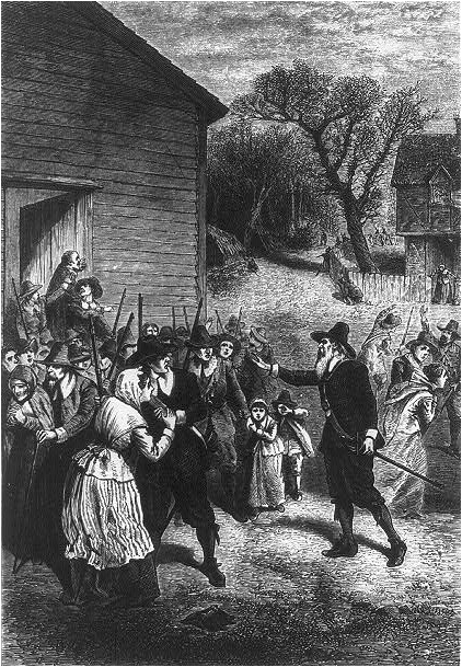
This image shows Massachusetts Bay Colonist John Endecott and approximately 90 of his men landing on Block Island , Rhode Island in August, 1636. His men attacked members of the Eastern Niantic tribe who were allied with the Pequots. The Eastern Niantics had killed a respected Boston trader, John Oldam,on Block Island earlier that summer. Endecott destroyed the villagers' crops, villages and canoes. He claimed to have killed 14 Indians. The Native Americans claimed that his men only killed one. This incident escalated the Pequot War. This image was drawn circa 1880 by A.fred R. Waud (1828-1891) for Scribner's Popular History of the United States Volume II, page 3. The image was engraved by Andrew Varrick Stout Anthony (1835-1906).

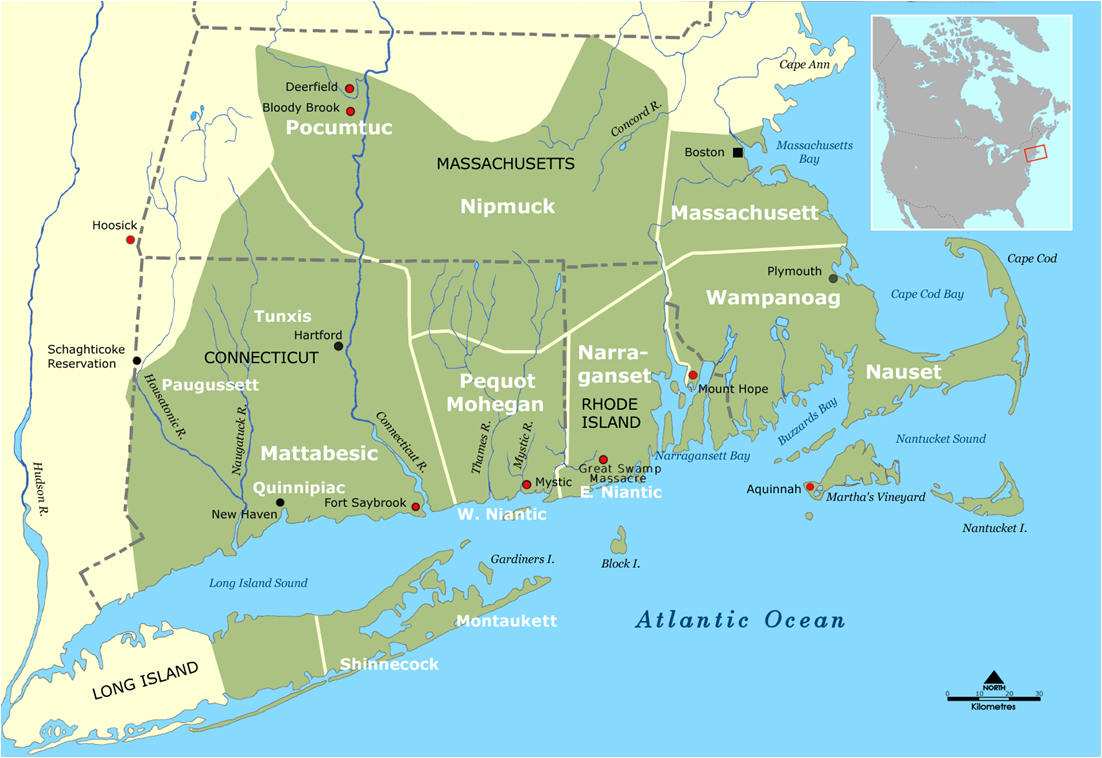
Before the arrival of the Europeans, Native American groups competed with each other to control the lands and resources of southern New England.
This map shows the tribal or Indian nation territories of southern New England. It is courtesy of the Pokanoket Tribe of the Wampanoag Nation.
When the Europeans arrived, the Indians nations had a choice of which European nation that they wanted to trade with and become allies.
This image known as “Captain Goswold Trades with the Indians” is probably Bristol, England merchant John Guy trading with Native Americans in Newfoundland in 1612. This image was created circa 1634 by Johann Theodore DeBry. It is courtesy of the Virginia Historical Society.

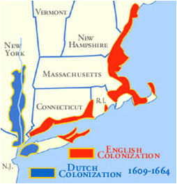
The Pequots and their allies mostly traded with the Dutch who had settled in what is now New York and the Hudson River Valley.
The Netherlands (the Dutch) controlled the Hudson River Valley from 1609-1664. They established New Netherland, a series of trading posts, towns, and forts up and down the Hudson River. This image is courtesy of Columbia County, New York.

The Narragansetts, the Wampanoags and their allies mostly traded and allied themselves with the English.
This map shows early English colonization in red, and mostly along the Atlantic Ocean. Dutch colonization is shown in blue. The Dutch settled near what is now New York Harbor and the Hudson River Valley. This map is courtesy of the National Park Service.

Efforts to control land and the fur trade led to a series of attacks and other violent incidents that increased tensions on all sides.
This watercolor shows English military engineer Lion Gardiner (1599-1663) in the Pequot War. It was painted by Charles Stanely Reinhart circa 1890 and is courtesy of Wikimedia Commons.

When the English burned a Pequot village and its crops, the Pequot began to raid and burn Connecticut towns. By 1637, approximately 30 English settlers had been killed or captured.
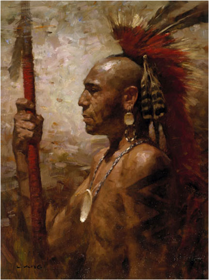
This image by Z.S. Liang (1953-) shows a Pequot Warrior. It is courtesy of the Artifacts Gallery.

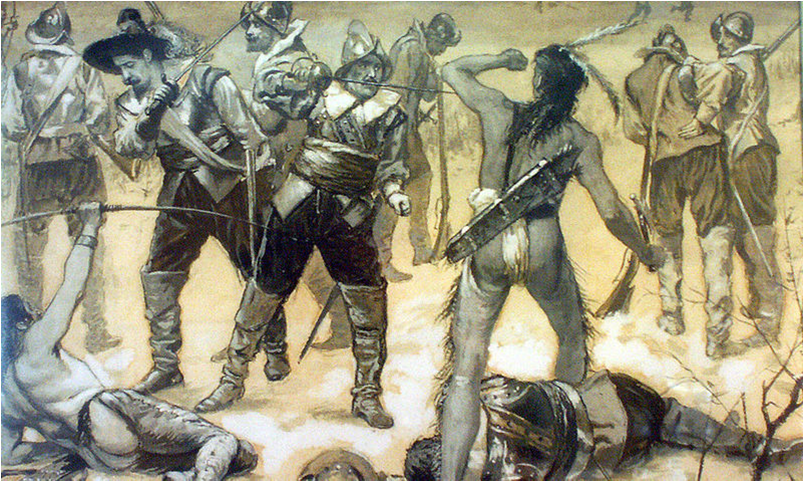
On May 26, 1637, Englishmen under Captain John Mason set fire to a fortified Pequot village near the Mystic River. They shot any people trying to escape the fire.
The Pequot War
Section 2, Lesson 8
Previous Lesson: Connecticut & New Hampshire
Next Lesson: King Philip’s War
When the Europeans arrived, the Indians nations had a choice of which European nation that they wanted to trade with and become allies.
This image known as "Captain Goswold Trades with the Indians" is probably Bristol, England merchant John Guy trading with Native Americans in Newfoundland in 1612. This image was created circa 1634 by Johann Theodore DeBry. It is courtesy of the Virginia Historical Society.
The Pequot War (1634-1638)
This image shows Massachusetts Bay Colonist John Endecott and approximately 90 of his men landing on Block Island , Rhode Island in August, 1636. His men attacked members of the Eastern Niantic tribe who were allied with the Pequots. The Eastern Niantics had killed a respected Boston trader, John Oldam,on Block Island earlier that summer. Endecott destroyed the villagers' crops, villages and canoes. He claimed to have killed 14 Indians. The Native Americans claimed that his men only killed one. This incident escalated the Pequot War. This image was drawn circa 1880 by A.fred R. Waud (1828-1891) for Scribner's Popular History of the United States Volume II, page 3. The image was engraved by Andrew Varrick Stout Anthony (1835-1906).
Before the arrival of the Europeans, Native American groups competed with each other to control the lands and resources of southern New England.
This map shows the tribal or Indian nation territories of southern New England. It is courtesy of the Pokanoket Tribe of the Wampanoag Nation.
When the Europeans arrived, the Indians nations had a choice of which European nation that they wanted to trade with and become allies.
This image known as “Captain Goswold Trades with the Indians” is probably Bristol, England merchant John Guy trading with Native Americans in Newfoundland in 1612. This image was created circa 1634 by Johann Theodore DeBry. It is courtesy of the Virginia Historical Society.

The Pequots and their allies mostly traded with the Dutch who had settled in what is now New York and the Hudson River Valley.
The Netherlands (the Dutch) controlled the Hudson River Valley from 1609-1664. They established New Netherland, a series of trading posts, towns, and forts up and down the Hudson River. This image is courtesy of Columbia County, New York.
The Narragansetts, the Wampanoags and their allies mostly traded and allied themselves with the English.
This map shows early English colonization in red, and mostly along the Atlantic Ocean. Dutch colonization is shown in blue. The Dutch settled near what is now New York Harbor and the Hudson River Valley. This map is courtesy of the National Park Service.
Efforts to control land and the fur trade led to a series of attacks and other violent incidents that increased tensions on all sides.
This watercolor shows English military engineer Lion Gardiner (1599-1663) in the Pequot War. It was painted by Charles Stanely Reinhart circa 1890 and is courtesy of Wikimedia Commons.
When the English burned a Pequot village and its crops, the Pequot began to raid and burn Connecticut towns. By 1637, approximately 30 English settlers had been killed or captured.
This image by Z.S. Liang (1953-) shows a Pequot Warrior. It is courtesy of the Artifacts Gallery.

On May 26, 1637, Englishmen under Captain John Mason set fire to a fortified Pequot village near the Mystic River. They shot any people trying to escape the fire.
This image shows the English and their Indian allies surrounding a Pequot fort near the Mystic River. It was drawn circa 1638 by John Underhill for his book Newes from America and is courtesy of Wikimedia Commons.
Of the 600-700 mostly women and children in the fort, seven survived to be taken prisoner. Seven escaped to the woods. The rest were killed.
The English commander John Mason declared that the attack against the Pequot was the act of a God who “laughed his Enemies and the Enemies of his People to scorn making [the Pequot] as a fiery Oven . . . Thus did the Lord judge among the Heathen, filling [Mystic] with dead Bodies.” The Narragansett and Mohegan warriors with the English were horrified by the actions and “manner of the Englishmen’s fight . . . because it is too furious, and slays too many men.” The Narragansett returned home and no longer participated in the war. This image is courtesy of forquignon.com.

This event, known as the “Mystic Massacre,” was the turning point of the Pequot war. The remaining members of the Pequot nation were hunted down and killed or made slaves by the English and their remaining Indian allies.
The English, the Mohegans, and the Narragansetts signed the Treaty of Hartford was on September 21, 1638 and ended the Pequot War. The Pequot lands and remaining people were divided up between the three groups. The few Pequot who managed to evade death or slavery were later assigned to reservations in Connecticut. This image, titled “The Pequot War,” is courtesy of the Library of Congress and Wikimedia Commons.

The Pequot War was one of the first events in which Native Americans in southern New England encountered European-style warfare and the idea of “total war.”
On December 13, 1636, the General Court of the Massachusetts Bay Colony ordered the organization of that colony’s militia. All males between the ages of 16 and 60 were required to possess arms and participate in the defense of the community. These early colonial militia units drilled once a week and provided guard details each evening to sound the alarm in case of an attack. This image of a colonial militia unit is courtesy of the Indian and Colonial Research Center, Old Mystic, Connecticut.
 After the Pequot War, an uneasy peace existed for almost 40 years between the English colonists and their Native American neighbors who were concerned about the increase of English power in the region.
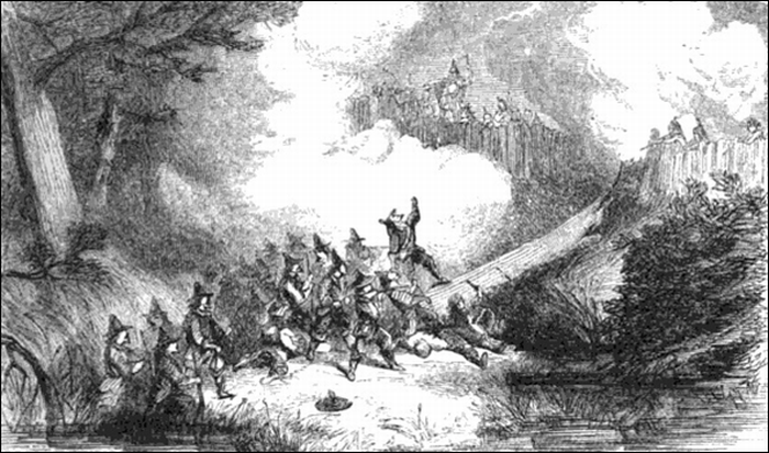
The Fairfield Swamp Fight occurred from July 13-14, 1637 and was the last battle of the Pequot War. It was located at what is now the city of Fairfield, Connecticut. Most if not all of the 110-200 Pequot Warriors were killed in the engagement. A few English colonists were wounded and survived. This image, titled “Battle at Fairfield Swamp” is courtesy of Wikimedia Commons.
King Philip’s War
Section 2, Lesson 9
Previous Lesson: The Pequot War

King Philip’s War (1675-1676)
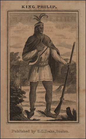
Metacomet (1639-1676) was the second son of Massasoit, Sachem or Chief of the Wampanoags. Like his father, at first Metacomet was a friend of the English colonists. He traded with the English colonists and took the Christian name “Philip.” He sometimes dressed as a European and bought some clothes in Boston, Massachusetts. Metacomet began to distrust the colonists, after his brother, Wamsutta, the Grand Sachem of the Wampanoags, died a suspicious death after returning from peaceful negotiations with the English. This image is fromThe History of Philip’s War, Commonly Called the Great Indian War, of 1675 and 1676. The book was by Benjamin Church and was printed circa1825 by Samuel Gardner Drake in Boston, Massachusetts.
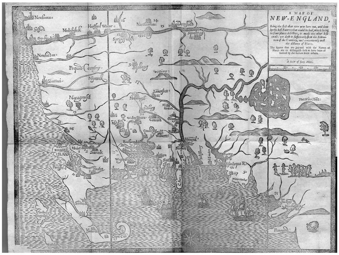
The English population of New England increased to approximately 30,000 by 1660 which led to more English settlements along the Atlantic coast and the Connecticut River Valley.
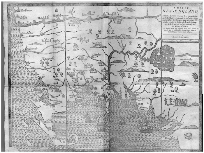
This map titled “A Map of New England,” was created by clergyman and historian William Hubbard (circa 1621-1704) for his book The History of the Indian Wars in New England. The book was published In London and Boston in 1677.
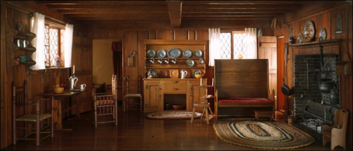
By 1675 there were approximately 90 towns or villages in Massachusetts and the Indians/Native Americans were being pushed from their land.
This miniature room is titled Massachusetts Living Room and Kitchen, 1675-1700. It is of the scale one inche equals one foot and was created circa 1940 by Mrs. James Ward Thorne (1882-1966). It is located in Gallery 11 of the Art Institute of Chicago.
The Wampanoag chief Metacomet (called by the English “King Philip”) retreated with his followers and allies to a swampy area of Massachusetts.
Metacomet (circa 1639-1676) before the war sold land to the English, but decided not to sell land for a period of seven years. The English began to take his land anyway. Some estimates have his Wampanoag tribe having only 300 warriors versus 10,000 English militiamen at the beginning of King Philip’s War. Later in the war, he had thousands of warriors as allies. This image was created by the Boston Silversmith, Paul Revere (1735-1818), for the 1772 edition of The Entertaining History of King Philip’s War by Benjamin Church. This line engraving, colored by hand, is the the Mabel Brady Garvan Collection of the Yale University Art Gallery. It is courtesy of Yale University and Wikimedia Commons.
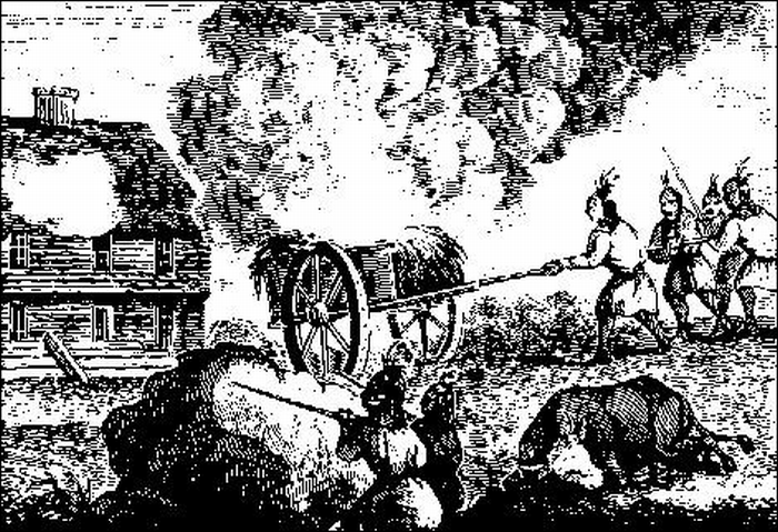
King Philip (Metacomet) began to gather other Indian allies. They attacked English frontier settlements, then went back into the swamps to hide.
This image probably shows Indians attacking the Haynes Garrison at Sugbury, Massachusetts on April 21, 1676. It shows the Native Americans have set a cart of hay or straw on fire, and are pushing it towards the wooden structure to also set it on fire. The image is titled Indians Attacking a Garrison House, from an Old Wood Engraving, and is courtesy of the Dover Public Library in Dover, New Hampshire.

In what was one of the bloodiest and costliest wars in New England, over half of the English towns were assaulted by Native Americans.
This drawing shows Native Americans attacking Lancaster, Massachusetts on August 22, 1675. Eight of the English inhabitants were killed. The image is titled “Indian Raid in 1675” from the publication History of the town of Lancaster, Massachusetts: From the First Settlement… by Abijah Perkins and Marvin Thomas Sawyer.
A turning point in the war came when the English defeated the Narragansetts at the Battle of Great Swamp.
At the Battle of Great Swamp on November 2, 1675, 1000 colonial militia and their Indian allies attacked a large fort constructed by the Narragansett Indians near Southport, Connecticut. The English won after a fierce fight, and the fort was burned. Some sources believe 300 Narragansetts were killed, and the rest had to attempt to survive in the swamp over the winter. The Narragansetts never fully recovered from this battle. This image is from the Harpers Magazine, published in 1857, and is courtesy of Wikimedia Commons.

As the English colonists became more organized, they gained victories, and many Native Americans began to leave King Philip’s forces.
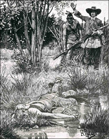
On July 8, 1675, Captain Benjamin Church, known as the first American “Ranger,” and his 36 men were attacked by approximately 300 Indians at Tiverton, Rhode Island. Church and his men held off the Indians until they were rescued. Forces under Church later killed King Philip. This image is an illustration from “Adventures of the Early Settlers of New England,” in Harper’s New Monthly Magazine, Vol. 15, 1857, page 31.
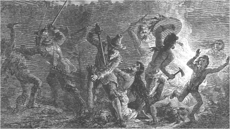
King Philip and his remaining forces were hunted down, and the war essentially ended with his death.
On August 12, 1676, King Philip was tracked down by colonists and Native Americans led by Captain Benjamin Church at Miery Swamp below Providence, Rhode Island. Philip was shot and killed by an Indian named John Alderman. Philip’s body was beheaded, and he was drawn and quartered. His head was displayed in Plymouth, Massachusetts for twenty years. This image titled “The Death of King Philip” was published in Harper’s Magazine, in 1883.
The English colonists now took much more land from the Native Americans, who had fled to other areas, or who had been sold into slavery.
During King Philip’s War, over 600 English colonists, and 3000 Native Americans died. Many Native Americans were sold as slaves to plantations in Bermuda. The Narragansetts and the Wampanoags were virtually eliminated as organized groups. This image titled “Early American Conflict” was published in the 1800s. It is courtesy of Wikimedia Commons.

The English colonists, who had won the war without much help from the British government, now began to feel more independent, and to slowly think of themselves as Americans.
William Goffe (circa 1605-circa 1679) was born in England, and was the son of a Puritan clergyman. He came to Borston in the summer of 1860, and became a Major-General in 1665. Tradition says that when the town of Hadley, Massachusetts was under attack by Indians on either June 12,1676 or September 1, 1676 (depending on the source), Goffe suddenly appeared among the panicked residents. He took command, and helped them to repulse the Indians. He then disappeared. This image is titled, “Goffe Rallying the Men of Hadley” was created for The Romance and Tragedy of Pioneer Life by Augustus L. Mason. It was published in 1883 by Jones Brothers and Company of Cincinnati, Ohio. The illustration appears on page 133. It is courtesy of the Library of Congress.
______________________________________________________________________________
Rhode Island
Section 2, Lesson 6
Previous Lesson: Massachusetts Bay Colony,
Next Lesson: Connecticut & New Hampshire,
Rhode Island
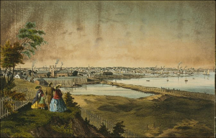
A view of the harbor of Providence, Rhode Island in 1858. This hand colored lithograph by John Bachelder is courtesy of the Library of Congress and Wikimedia Commons.

Roger Williams did not believe that Church members in Massachusetts should control the legislature or General Court.
A picture of a statue of Roger Williams from the publication, Boston, the Place and the People . It was created circa 1903 and is courtesy of Wikimedia Commons.
Roger Williams believed that there should be a separation of the Church from the State (government).
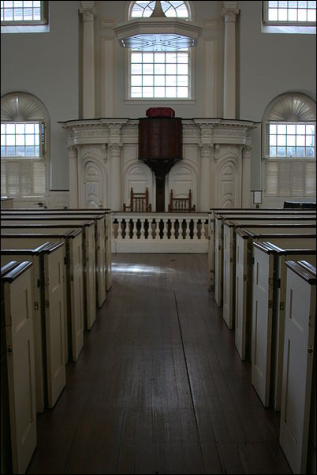
Interior of the Old South Meeting House in Boston, Massachusetts. This image was taken on May 11, 2010 by Erwin Bernal and is courtesy of Wikimedia Commons.
The idea of “Separation of Church and State” would later become a basic principle of the United States Government.
Section 2, Lesson 9
Previous Lesson: The Pequot War

King Philip’s War (1675-1676)
Metacomet (1639-1676) was the second son of Massasoit, Sachem or Chief of the Wampanoags. Like his father, at first Metacomet was a friend of the English colonists. He traded with the English colonists and took the Christian name “Philip.” He sometimes dressed as a European and bought some clothes in Boston, Massachusetts. Metacomet began to distrust the colonists, after his brother, Wamsutta, the Grand Sachem of the Wampanoags, died a suspicious death after returning from peaceful negotiations with the English. This image is fromThe History of Philip’s War, Commonly Called the Great Indian War, of 1675 and 1676. The book was by Benjamin Church and was printed circa1825 by Samuel Gardner Drake in Boston, Massachusetts.
The English population of New England increased to approximately 30,000 by 1660 which led to more English settlements along the Atlantic coast and the Connecticut River Valley.
This map titled “A Map of New England,” was created by clergyman and historian William Hubbard (circa 1621-1704) for his book The History of the Indian Wars in New England. The book was published In London and Boston in 1677.

By 1675 there were approximately 90 towns or villages in Massachusetts and the Indians/Native Americans were being pushed from their land.
This miniature room is titled Massachusetts Living Room and Kitchen, 1675-1700. It is of the scale one inche equals one foot and was created circa 1940 by Mrs. James Ward Thorne (1882-1966). It is located in Gallery 11 of the Art Institute of Chicago.

The Wampanoag chief Metacomet (called by the English “King Philip”) retreated with his followers and allies to a swampy area of Massachusetts.
Metacomet (circa 1639-1676) before the war sold land to the English, but decided not to sell land for a period of seven years. The English began to take his land anyway. Some estimates have his Wampanoag tribe having only 300 warriors versus 10,000 English militiamen at the beginning of King Philip’s War. Later in the war, he had thousands of warriors as allies. This image was created by the Boston Silversmith, Paul Revere (1735-1818), for the 1772 edition of The Entertaining History of King Philip’s War by Benjamin Church. This line engraving, colored by hand, is the the Mabel Brady Garvan Collection of the Yale University Art Gallery. It is courtesy of Yale University and Wikimedia Commons.

King Philip (Metacomet) began to gather other Indian allies. They attacked English frontier settlements, then went back into the swamps to hide.
This image probably shows Indians attacking the Haynes Garrison at Sugbury, Massachusetts on April 21, 1676. It shows the Native Americans have set a cart of hay or straw on fire, and are pushing it towards the wooden structure to also set it on fire. The image is titled Indians Attacking a Garrison House, from an Old Wood Engraving, and is courtesy of the Dover Public Library in Dover, New Hampshire.

In what was one of the bloodiest and costliest wars in New England, over half of the English towns were assaulted by Native Americans.
This drawing shows Native Americans attacking Lancaster, Massachusetts on August 22, 1675. Eight of the English inhabitants were killed. The image is titled “Indian Raid in 1675” from the publication History of the town of Lancaster, Massachusetts: From the First Settlement… by Abijah Perkins and Marvin Thomas Sawyer.

A turning point in the war came when the English defeated the Narragansetts at the Battle of Great Swamp.
At the Battle of Great Swamp on November 2, 1675, 1000 colonial militia and their Indian allies attacked a large fort constructed by the Narragansett Indians near Southport, Connecticut. The English won after a fierce fight, and the fort was burned. Some sources believe 300 Narragansetts were killed, and the rest had to attempt to survive in the swamp over the winter. The Narragansetts never fully recovered from this battle. This image is from the Harpers Magazine, published in 1857, and is courtesy of Wikimedia Commons.

As the English colonists became more organized, they gained victories, and many Native Americans began to leave King Philip’s forces.
On July 8, 1675, Captain Benjamin Church, known as the first American “Ranger,” and his 36 men were attacked by approximately 300 Indians at Tiverton, Rhode Island. Church and his men held off the Indians until they were rescued. Forces under Church later killed King Philip. This image is an illustration from “Adventures of the Early Settlers of New England,” in Harper’s New Monthly Magazine, Vol. 15, 1857, page 31.

King Philip and his remaining forces were hunted down, and the war essentially ended with his death.
On August 12, 1676, King Philip was tracked down by colonists and Native Americans led by Captain Benjamin Church at Miery Swamp below Providence, Rhode Island. Philip was shot and killed by an Indian named John Alderman. Philip’s body was beheaded, and he was drawn and quartered. His head was displayed in Plymouth, Massachusetts for twenty years. This image titled “The Death of King Philip” was published in Harper’s Magazine, in 1883.

The English colonists now took much more land from the Native Americans, who had fled to other areas, or who had been sold into slavery.
During King Philip’s War, over 600 English colonists, and 3000 Native Americans died. Many Native Americans were sold as slaves to plantations in Bermuda. The Narragansetts and the Wampanoags were virtually eliminated as organized groups. This image titled “Early American Conflict” was published in the 1800s. It is courtesy of Wikimedia Commons.
The English colonists, who had won the war without much help from the British government, now began to feel more independent, and to slowly think of themselves as Americans.
William Goffe (circa 1605-circa 1679) was born in England, and was the son of a Puritan clergyman. He came to Borston in the summer of 1860, and became a Major-General in 1665. Tradition says that when the town of Hadley, Massachusetts was under attack by Indians on either June 12,1676 or September 1, 1676 (depending on the source), Goffe suddenly appeared among the panicked residents. He took command, and helped them to repulse the Indians. He then disappeared. This image is titled, “Goffe Rallying the Men of Hadley” was created for The Romance and Tragedy of Pioneer Life by Augustus L. Mason. It was published in 1883 by Jones Brothers and Company of Cincinnati, Ohio. The illustration appears on page 133. It is courtesy of the Library of Congress.
______________________________________________________________________________
Rhode Island
Section 2, Lesson 6
Previous Lesson: Massachusetts Bay Colony,
Next Lesson: Connecticut & New Hampshire,

Rhode Island
A view of the harbor of Providence, Rhode Island in 1858. This hand colored lithograph by John Bachelder is courtesy of the Library of Congress and Wikimedia Commons.

Roger Williams did not believe that Church members in Massachusetts should control the legislature or General Court.
A picture of a statue of Roger Williams from the publication, Boston, the Place and the People . It was created circa 1903 and is courtesy of Wikimedia Commons.

Roger Williams believed that there should be a separation of the Church from the State (government).
Interior of the Old South Meeting House in Boston, Massachusetts. This image was taken on May 11, 2010 by Erwin Bernal and is courtesy of Wikimedia Commons.

The idea of “Separation of Church and State” would later become a basic principle of the United States Government.
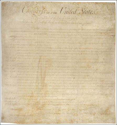
The first amendment to the United States Constitution includes the following: “Congress shall make no law respecting an establishment of religion, or prohibiting the free exercise thereof.” This image is courtesy of the Library of Congress.

But that would be over a hundred years later. At this time, the Puritans believed their government was controlled by the rules of their church.
The interior of Old Ship Church in Hingham, Massachusetts. Old Ship Church was built in 1681 and is the only remaining Puritan meeting house in the United States. This photo was taken on October 14, 2006 by Michael Carter. It is courtesy of Wikimedia Commons.
Roger Williams was banished from Massachusetts and spent a winter with Native Americans (Wampanoags).
This image is titled “Roger Williams and Narragansetts.” Williams, although recently ill, walked 105 miles though a deep snow from Salem, Massachusetts to Narragansett Bay. He was taken by the Wampanoags to the winter camp of their chief, Massasoit. This image was created by James Charles Armytage circa 1856. It is courtesy of the New York Public Library and Wikimedia Commons.

Williams purchased land from the Native Americans for a settlement that he would name Providence. He accepted anyone into his community.
The First Baptist Church in America was established by Roger Williams in Providence, Rhode Island in 1638. This building for the First Baptist Church was erected in 1776. This image first appeared in Frank Leslie’s Illustated News in 1877. This image is courtesy of Wikimedia Commons.

Nearby towns eventually joined Providence, and started the colony of Rhode Island.
Despite its name, most of Rhode Island is on the mainland of the United States. Its official name is “Rhode Island and Providence Plantations” because of the merger of Roger Williams Providence colony and an English colony in the area of Newport on Aquidneck Island. The official and historical name of Aquidneck Island is Rhode Island, from which the state acquired its name. This image is courtesy of Wikimedia Commons.

One of those who came to Rhode Island seeking the ability to worship as she chose was Anne Hutchinson.
The Statue of Anne Hutchinson at the Massachusetts State House in Boston, Massachusetts. It was erected in 1922. This image was taken by Michael E. Ray on June 30, 2005. It is courtesy of Wikimedia Commons.

She believed that people could speak to God directly, not only through their ministers.
Anne Hutchinson (1591-1643) lived in Massachusetts, Rhode Island and New Netherland (New York). She held Bible meetings for women that soon appealed to some men. Eventually she went beyond Bible study to proclaim her own interpretations of sermons. Her beliefs would cause trouble with the Puritans who controlled Massachusetts. This image is courtesy of the Public Broadcasting Service.
 Hutchinson also thought that women should have a more important place in Puritan society.
Mary Dyer (circa 1611-1660) was friend of Anne Hutchinson. Dyer was an English Puritan who eventually turned to the religion of the Quakers. She was hanged for repeatedly defying a Puritan law banning Quakers from Massachusetts. This image, titled Mary Dyer led to Execution on Boston Common, 1 June 1660 was created by an unknown artist in the 1800s. It is courtesy of the Brooklyn, New York Museum and Wikimedia Commons.

The Puritans put her on trial for believing that faith in God allowed people to enter “heaven,” not good works. The Puritans banished her from Massachusetts.
Anne Hutchinson was brought to civil trial in 1637. She was forty-six years old and pregnant for the fifteenth time. This image titled Anne Hutchinson on Trial was created by Edwin Austin Abbey in 1901 for Scribner’s Popular History of the United States. It is courtesy of Wikimedia Commons.

She and her family lived in Rhode Island until her husband died.
This image of Anne Hutchinson Preaching in Her House was created by Howard Pyle in 1901. It is in the Library of Congress and the Granger Collection in New York, New York.

She moved to the Dutch colony of New Amsterdam, and was killed by the Native Americans.
The massacre of Anne Hutchinson and her family took place near what is now Pelham Bay, New York in 1643. This image is a wood engraving from the 1800s found in the Granger Collection of New York, New York.
______________________________________________________________________________
Massachusetts Bay Colony
Section 2, Lesson 5
Previous Lesson: The Plymouth, Massachusetts Colony.
Next Lesson: Rhode Island.
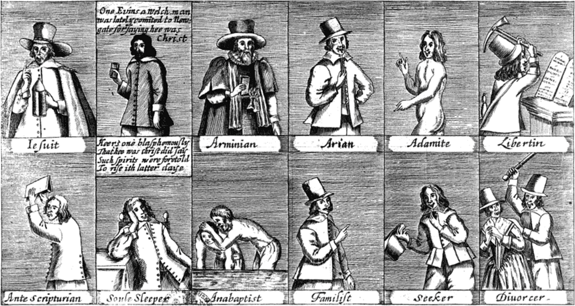
The Separatists or Pilgrims that settled the Plymouth Colony were only a small portion of people who disagreed with practices of the Anglican Church.
A broadsheet or poster of people who disagreed with the practices of the Anglican Church. This image, titled “A Catalogue of the Severall Sects and Opinions in England and Other Nations: With a Briefe Rehearsall of Their False and Dangerous Tenents” was published in 1647. It is located in the British Museum and is courtesy of Wikimedia Commons.

The Puritans who were prominent in the English Parliament were not happy with their situation after King Charles I dissolved the Parliament.
King Charles I of England . His authority was constantly challenged by the Parliament which included numerous Puritans. He dissolved the Parliament in 1629. This image by Sir Anthony van Dyck 1599-1641) was painted in April, 1634 and is courtesy of Wikimedia Commons.
King Charles I of England . His authority was constantly challenged by the Parliament which included numerous Puritans. He dissolved the Parliament in 1629. This image by Sir Anthony van Dyck 1599-1641) was painted in April, 1634 and is courtesy of Wikimedia Commons.

Many Puritans gave up their idea of attempting to “purify” the Anglican Church from within, and began to migrate to the Americas.
This image titled “Attempted Flight of the Puritans” was created circa 1876 for A Popular History of the United States by William Cullen Bryant and Sydney Howard Gay. It appears on page 377.

Their movement was known as the “Great Migration.”
This map shows that while we in the United States are familiar with the Puritans migrating to New England, most of the Puritans migrated to the Caribbean. The map, titled “Streams of Emigration from England, 1620-1642” was produced circa 1921 and is from the book The Founding of New England by James Truslow Adams, page 120.
The Great Migration came about because Puritans requested the king to grant them a charter to form the Massachusetts Bay Company.
This is the first seal of the Massachusetts Bay Colony. It depicts a dejected Indian/Native American with his arrows turned down. He is saying “Come over and help us.” In the Bible, in Acts Chapter 16, Verse 9, Christians are told "And a vision appeared to Paul in the night; There stood a man of Macedonia, and prayed him, saying, Come over into Macedonia, and help us." This image, drawn before 1780, is courtesy of Wikimedia Commons.

The Puritans received their charter, and from 1629-1630 17 ships and more than 1000 settlers left to establish the Massachusetts Bay Colony, which was located north of the Plymouth Colony.
Five ships and 300 colonists led by Francis Higginson left for New England on May 1, 1629. The Winthrop Fleet left England on April 8, 1630 with 12 ships and over 700 people. This image titled “Arrival of the Winthrop’s Ships in Boston Harbor” was created circa 1880 by William F. Halsall (1841-1919). The ships are just coming to anchor, with the flagship in the foreground. The flagship, named the Arbella after one of her passengers, Lady Arbella Johnson, weighed 350 tons and carried 23 cannon. The ship in the right background is the Jewel. The ship in the left background is the Talbot.
These expeditions to the Massachusetts Bay Colony were much better organized and equipped than those to Jamestown and Plymouth.
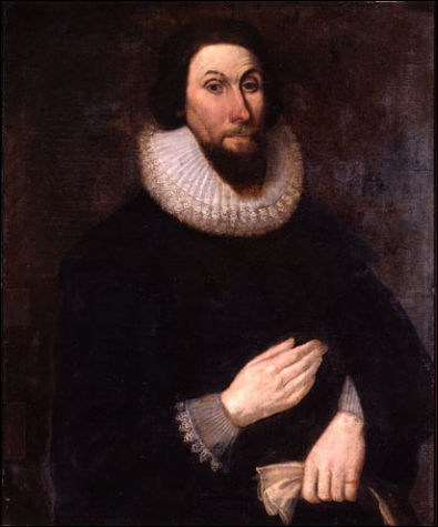
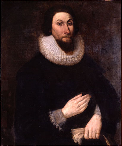
John Winthrop (circa 1587-1649) lead the first large wave of Puritans to New England in 1630. He was the first governor of the Massachusetts Bay Colony. This image, produced in the 1600s is courtesy of Wikimedia Commons.

These expeditions were made up mostly of families, instead of only males.
In this image of a Puritan family, a father is teaching his children religious songs instead of “vain and trifling ballads.” This image is from the frontispiece of “Tenor of the whole Psalmes in Four Parts” which was published in London, England in 1563.

The settlers brought large amounts of food, clothing, tools, and livestock with them.
This image, titled “A Puritan Wedding Procession,” was created circa 1911 for the series Baldwin’s Readers.

The first governor, John Winthrop, called the new colony “A City Upon a Hill” because it was to be a model of Christianity to the rest of the world.
The first private charity in New England was the Scots Charitable Society. It was formed in Boston in 1657. This image is courtesy of the Library of Congress.
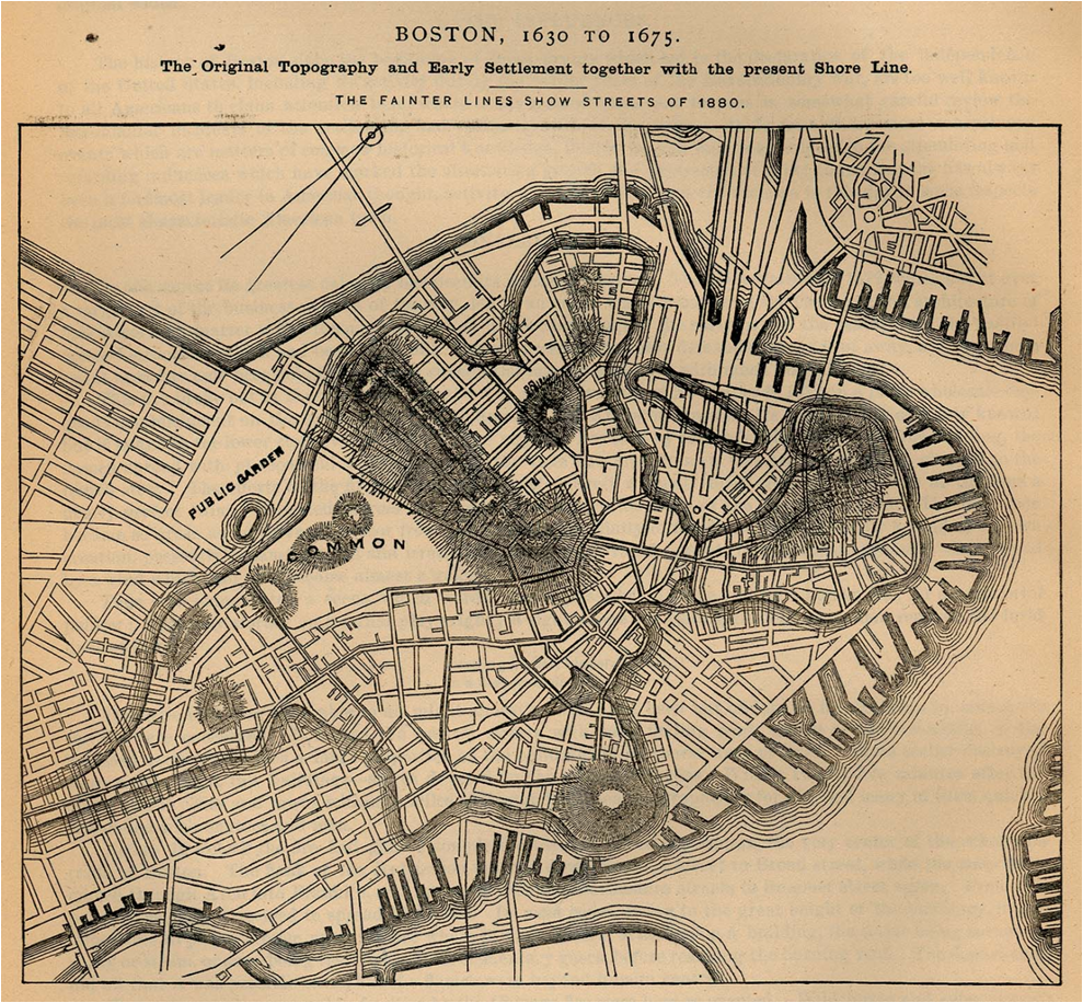
The capital of the Massachusetts Bay Colony was Boston.
This map is titled “Boston, 1630 to 1675. The Original Topography and Early Settlement together with the present Shore Line.” It was published in 1886 as part of the “Report on the Social Statistics of Cities, Compiled by George E. Waring Jr., United States Census Office.”

The Puritans transformed the Massachusetts Bay Company into a commonwealth or self-governing political unit. It was the first of its kind in America.
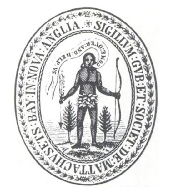
The seal of the Commonwealth of Massachusetts was adopted on June 4, 1885. In latin, around the figure holding the bow is the following phrase: “By the sword we seek peace, but peace only under liberty.” This image of courtesy of Wikimedia Commons.
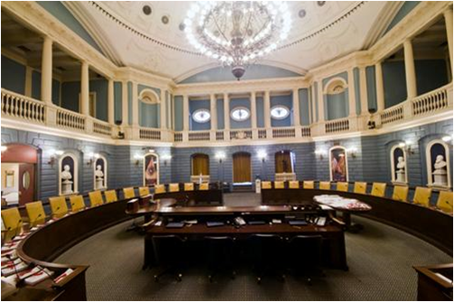
The laws of the Commonwealth of Massachusetts were created by a General Court, which is now the name of the state legislature.
This image of the Senate Chamber of the Massachusetts General Court is courtesy of the Commonwealth of Massachusetts.

The first General Court included the investors in the Massachusetts Bay Company.
The first private insurance company opened in Boston in 1724. This image is courtesy of the Library of Congress.
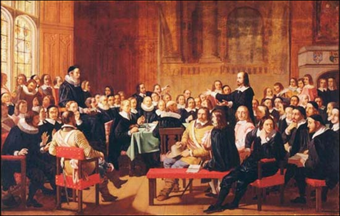
Later all adult freeman (not bonded servants or slaves) became members of the company provided that they were church members.
This painting of the Westminster Assembly of Divines was painted in 1844 by John Rogers Herbert. It is courtesy of Wikimedia Commons.

The Puritans came to American seeking freedom to worship as they chose to worship…
Box pews in the Colonial Meeting House in Millville, Massachusetts. This image was taken by Paul Wainwright of paulwainwrightphotography.com and is courtesy of Wikimedia Commons.

…but they did not believe in religious toleration for others.
This image of a man in the stocks who did not obey Puritan law is titled “Puritan Morality Enforced.” This is a colorized version of the original which appeared in Benjamin Lossing’s Our Country: A Household History For All Readers….Page 387.
_______________________________________________________________________________
The Plymouth, Massachusetts Colony
Section 2, Lesson 4
Previous Lesson: Jamestown
Next Lesson: Massachusetts Bay Colony

The Plymouth, Massachusetts Colony
The Landing of the Pilgrims by Henry A. Bacon. This image was created circa 1877 and is courtesy of Wikimedia Commons.
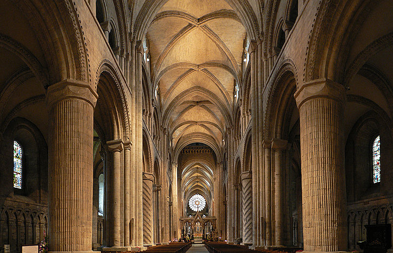
Before 1520, The Roman Catholic Church used to be “the” Christian Church of Europe.
The nave of the Durham Cathedral in Durham, England. The cathedral was founded in 1093 CE and is considered one of the finest examples of Norman architecture. This photo was taken August 13, 2010 by Oliver Bonjoch and is courtesy of Wikimedia Commons.

Then the Protestant Reformation began by those who thought people could worship God in different ways.
This print shows Martin Luther, a German priest and university professor, burning a document stating that he was banned from the Catholic Church. Luther strongly disputed some claims by the Catholic Church, such as the belief that one’s sins would be forgiven if they gave money to the church. This image is courtesy of the Library of Congress.

Back to the English Colonies… While Virginia had the first permanent English Settlers in America…
Making Pottery at Jamestown. This image by Sidney King is courtesy of the National Park Service.

….Massachusetts is more famous for its English settlers, the Puritans and the Pilgrims.
Pilgrims Going to Church. This image by George Henry Boughton was painted in 1867. It is courtesy of Wikimedia Commons.
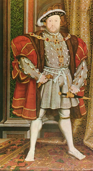
Their story began in 1534 when England’s King Henry VIII wanted to break away from the Roman Catholic Church.
Henry VIII (1491-1547) was the second monarch of the House of Tudor. This portrait was created by Hans Holbein the Younger. It is located in the Walker Art Gallery, Liverpool, United Kingdom. It is courtesy of Wikimedia Commons.
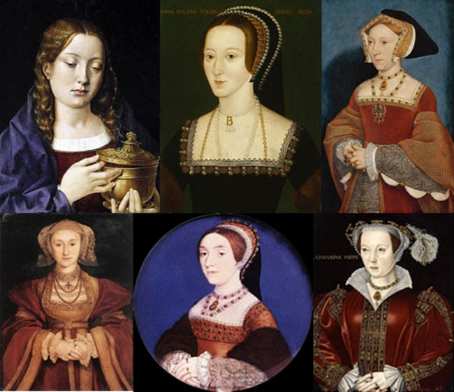
Henry VIII had six wives (not at the same time). The Catholic Church did not want him to divorce one of his wives to marry another (Anne Boleyn), so he decided to form his own church.
These images are courtesy of Wikimedia Commons.
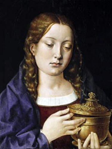
Catherine of Aragon
Catherine of Aragon (1485-1536). Henry VIII’s first wife and mother of Mary I (also known as “Bloody Mary.” This image is courtesy ofWikimedia Commons.

Anne Boleyn
Anne Boleyn (1501-1536) was the second wife of Henry VIII and the mother of Queen Elizabeth I. This image is courtesy of Wikimedia Commons.
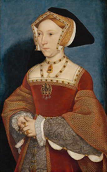
Jane Seymour
Jane Seymour (1508-1537) was the third wife, and the mother of King Edward VI. This image is courtesy of Wikimedia Commons.

Anne of Cleves
Anne of Cleves (ca. 1515-15457was the fourth wife. He was married to her for six months. This image is courtesy of Wikimedia Commons.
Catherine Howard
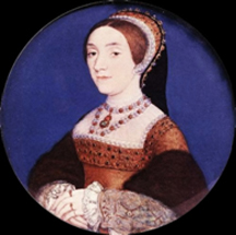
Catherine Howard (1525-1542) was the fifth wife of Henry VIII. He had her beheaded . This image is courtesy of Wikimedia Commons.

Catherine Parr
Catherine Parr (1512-1548) was the sixth wife of Henry VIII. She had four husbands. This image is courtesy of Wikimedia Commons.

His new church would be called the Church of England, or the Anglican Church.
Anglican Choir Music. A guest choir practices for Evensong (Evening Prayer) in York Minster, a gothic cathedral in York,England. The minster is the seat of the Archbishop of York, the second-highest office of the Church of England. This image, taken February 1, 1999 by Man vyi is courtesy of Wikimedia Commons.
After the American Revolution, the Anglican Church in America became known as the Episcopal Church.
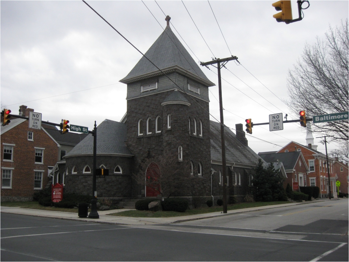
The first services in this building for the Prince of Peace Memorial Church in Gettysburg, Pennsylvania were condicuted in July, 1900. This Episcopal church is located on the southwest corner of the intersection of High Street and Baltimore Street. This photograph by Robert Housch was taken facing southwest at approximately 2:30 PM on Sunday, January 4, 2009.

The Anglican Church, because it was a Christian non-Catholic Church, was a Protestant Church.
Canterbury Cathedral is located in Canterbury, England. This structure was built and rebuilt from 1070 to 1834. The Archbishop of Canterbury is the leader of the Church of England/Anglican Church. This photograph was taken facing south by Hans Musil in September, 2005. It is courtesy of Wikimedia Commons.

Some members of the Anglican Church felt that its customs and services were still too “Catholic.”
A statue of the Virgin Mary which is located above the side entrance at Westminster Abbey. The large, gothic Westminster Abbey is located in Westminster, London, England. Westminster Abbey is the traditional place of coronation and burial of English and later British kings and queens. This photograph is courtesy of Wikimedia Commons.

The Puritans wanted to stay in the Church of England and attempt to “purify” it of its Catholic ways from within.
This 1500s cartoon shows a Puritan minister, preaching from the Bible, being pulled from his pulpit by “enemies of God’s word.” This image is from Henry D. Traill’s Social England.

Another group, known as the Separatists, felt the Church could not be changed.
Separatists were bothered by the elaborate rituals of the Church of England. This service, held at St. Paul’s Cathedral, London, England circa 1618, shows King James I, seated in an elevated box in the rear, and surrounded by his family. This image by an anonymous artist is courtesy of the Society of Antiquaries in London.
The Separatists wanted to “separate” from the Church of England to worship as they chose.
“Landing of the Pilgrims” by Michele Felice Corne was painted circa 1805. While there are many historical inaccuracies, the topography of the area where the Pilgrims landed is generally correct. This image is courtesy of the White House Historical Association.

Many Separatists not only left the church, they moved to The Netherlands (Holland) to live and worship.
The Netherlands is shown in dark green. The European Union is in light green. Europe is the darker gray. The countries surrounding Europe are colored light gray. This map was created in October, 2009 by nuclearvacuum and is courtesy of Wikimedia Commons.

These groups of Separatists who moved for the sake of religious tolerance called themselves Pilgrims for the Pilgrimage they had made.
“The First Thanksgiving at Plymouth” was painted by Jennie A Brownscombe (1850-1936) in 1914.
While they had religious freedom in Holland, they were Englishmen and didn’t want to raise their children to be Dutch.
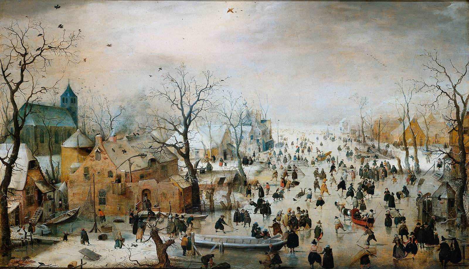
“Winter Landscape with Skaters.” Crowds of Dutch people are depicted on the ice in a scene that stretches far into the distance. There is a considerable variety among the figures, both in clothing and in what they are doing. Some of those portrayed are having fun, while others appear to be working. This oil painting by Hendrick Avercamp (1585-1634) was produced circa 1608 and is courtesy of Wikimedia Commons.
They wanted to live as Englishmen, but not in England under the rules of the Anglican Church.
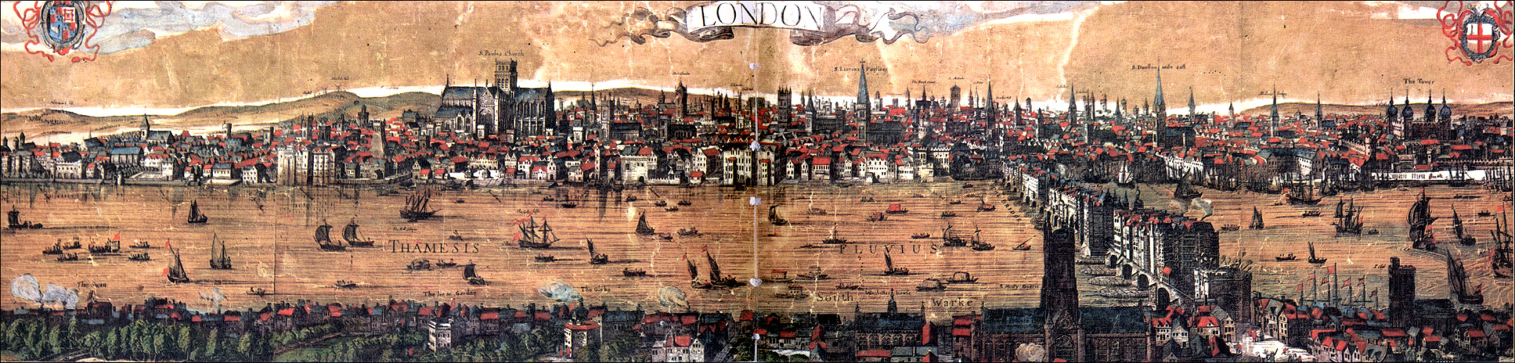
This panoramic view of London was painted by Nicholas Visscher circa 1616. The Thames River is in the foreground. Crossing the river near the right of the painting is London Bridge. The large structure in the left background is St. Paul’s Church. This image is courtesy of the British Museum.

Also, many of the Pilgrims were forced to do “lowly” jobs for the Dutch and it was taking them a long time to establish their own businesses. Many of them were living in poverty.
This painting shows a Dutch Lacemaker in 1662. It is titled La Dentelliere and was painted by Caspar Netscher (1639-1664) and is courtesy of worldtrade.com.
So they chose to live in America.
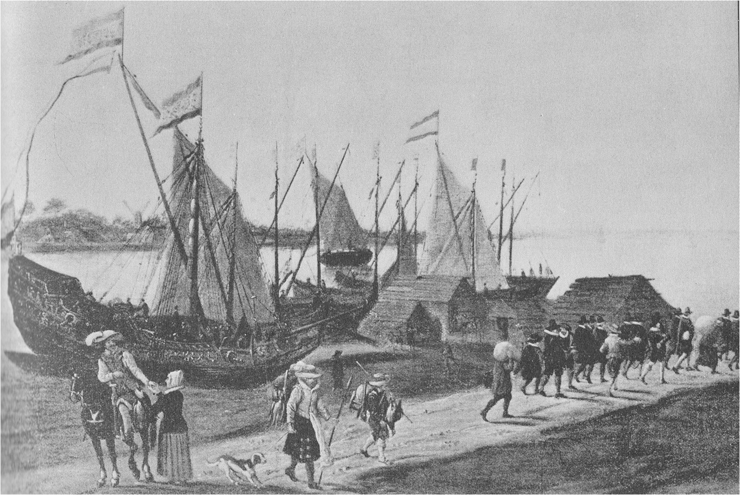
“Departure of the Puritans From Holland.” This painting by an unknown Dutch artist shows the Pilgrims on the dock of Leyden, The Netherlands. They are ready to board their ship, the Speedwell which was to take them to Plymouth, England before they sailed to America. This image appeared in Harpers Weekly on March 9, 1895.

The Plymouth Company, who sponsored the Pilgrims, wanted to promote fishing colonies in “Northern Virginia” which at that time meant the land between Pennsylvania and Newfoundland.
The Plymouth Company was founded because money was to be made in fishing, especially cod. This is an Atlantic Cod or Gadus Morhua. Cod could easily be preserved by salting and drying and could be taken from North America to England without spoiling or rotting. Cod was very plentiful in “Northern Virginia,” especially that part of Massachusetts now known as Cape Cod. This image is courtesy of Wikimedia Commons.

The Pilgrims were supposed to settle along the Hudson River, in what is now New York State, which was the northern boundary of “Virginia.”
The Hudson River is in the foreground. The Catskill Mountains are in the background. This photograph was taken by Daniel Case on September 29, 2007 near Rhinecliff, New York. This image is courtesy of Wikimedia Commons.

When the Pilgrims reached England to prepare to sail for America they discovered that another group would be traveling with them.
The Separatists (Pilgrims) prepared to leave England for America from Southampton, on the southern coast of Great Britain. It was a walled port city as shown in this print from the 1600s. This image is courtesy of the Radio Times Hulton Picture Library.

The Plymouth Company recruited more people to make the colony a success. These were mostly poorer, working class people who were members of the Church of England.
This image is titled Heads of Six of Hogath’s Servants. It was painted by William Hogarth circa the 1750s and is courtesy of Wikimedia Commons.
The Pilgrims, who called themselves “Saints,” were now outnumbered by these newcomers whom they called “Strangers.” The two groups would have an uneasy relationship as they sailed to America.
The masts on the ship Mayflower II in the fog. This photo by pundit was taken on December 25, 2007 and is courtesy of Wikimedia Commons.
They left England in two ships, but one, the Speedwell, kept leaking and they landed in an English port.
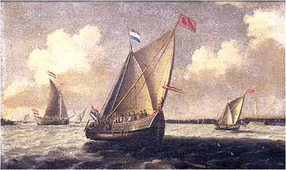
Dutch seascape by Verwer. The ships painted are the size of the Speedwell, the small ship in which some of the pilgrims sailed from Holland to England. It is possible that this painting is meant to show the Pilgrims aboard the Speedwell (center) when they sailed from Holland to England. However, the artist has painted it as a Dutch vessel, instead of an English vessel which the Speedwell was. This image by Abraham de Verwer (circa 1585-1650) was painted circa 1620-1640, and it is courtesy of Pilgrim Hall.

The Speedwell passengers who wanted to continue were crowded onto the other ship, theMayflower.
“Sailing of the Pilgrims from Plymouth, England” was painted by Charles Shimmin in the 1800s. It is on display at the Woolaroc Museum in Bartlesville, Oklahoma.

The Mayflower first reached Cape Cod in what is now Massachusetts.
These are the dunes at Sandy Neck Beach on Cape Cod, Massachusetts. This image by Mr. Senseless was taken in March, 2007. It is courtesy of Wikimedia Commons.

When they tried to go south to the Hudson River, they nearly shipwrecked in some difficult waters.
This Iillustration is from the book The Mayflower and Her Log, Complete, July 15, 1620—May 6, 1621, Chiefly from Original Sources(compiled by Azel Ames, published 1907).

They chose to go back to the Cape Cod area and settle in an area which had previously been named Plymouth, after the town that they had finally left in England.
The Mayflower was a Dutch cargo ship that weighed approximately 180 tons and had a crew of 25-30. Captain John Smith of the Jamestown Colony had explored New England after he left Jamestown, and wrote a book about his journey. He named this area Plymouth in 1614, six years before the Pilgrims arrived. The Pilgrims brought along his book as a guide. This image, titled “The Mayflower in Plymouth Harbor” was painted in 1882 by William Halsall. It is at the Pilgrim Hall Museum in Plymouth, Massachusetts and is courtesy ofWikimedia Commons.

Some, especially the “Strangers,” thought that because they were outside the “Virginia” land that Virginia’s laws now did not apply to them. So to govern themselves…
Between 1605 and 1608 the French explorer, Samuel de Champlain explored and mapped what is now the New England coast. He drew this map of Plymouth Harbor, which he named Port Saint Louis. The Native America/Indian village shown here is probably the home to Squanto’s Patuxet tribe. This map was included in Champlains’ Voyages. This map is courtesy of the National Park Service.
…the “Saints” and the “Strangers” agreed to form a political body to write laws “for the General good of the Colony.”
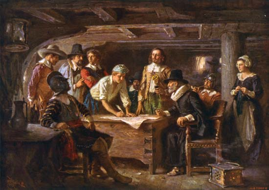
This image, titled The Mayflower Compact, 1620, depicts passengers on the Mayflower signing the document which would govern the way that they would act when they stepped onto land to begin their new lifes in America. This painting by Jean Leon Gerome Ferris (1863-1930) is courtesy of WWikimedia Commons.

They also promised “all due submission and obedience” to these laws.
This memorial bas relief of the Signing of the Mayflower Compact is on Bradford Street in Provincetown, Massachusetts, on the Pilgrim Monument. There were 102 passengers on the Mayflower. 41 of them, all adult males, signed the Mayflower Compact. The photograph of this work was taken on March 3, 2007 by Peter Whitlock. It is courtesy of Wikimedia Commons.

William Bradford’s (1590-1657) transcription of the Mayflower Compact. This page is from his book,. Of Plimoth Plantation, putlished in 1645. It is courtesy of the Commonwealth of Massachusetts.

Their document, known as the Mayflower Compact, was an important step towards self-government, and a basis for future constitutions.
“We whose names are under written …do…covenant and combine our selves together into a civil body politic, for our better ordering and preservation…” This image, titled “Signing of the Mayflower Compact” was painted in 1900 by Edward Percy Moran (1862-1935). It is located in Pilgrim Hall Museum.

An exploring party went ashore and found the land “…the best they could find…”
The exploring party went ashore at Plymouth Harbor on December 21, 1620. Bradford noted “it was the best they could find, and the season and present necessity made them glad to accept of it. The records from the 1600s do not mention Plymouth Rock. Some inaccuracies are that the Pilgrims are wearing trousers and other costumes more typical of the early 1800s than the early 1600s. The painting by Sarony & Major was circa 1846. It is titled “The Landing of the Pilgrims, on Plymouth Rock, December 11th 1620. “ Note the title says December 11th, not December 21st. It is courtesy of the the Library of Congress.
The first structure to be built, a “Common House” took two weeks to complete during harsh weather.
The first structure to be completed, the Common House, was a twenty-foot square thatched building which probably bore little resemblance to this large structure. This image titled “The Pilgrims Holding Their First Meeting for Public Worship in America “ is by Georg Johann Schwartze (1814-1874). It is at the Pilgrim Hall Museum in Plymouth, Massachusetts.

That winter, the colonists at Plymouth, like the Jamestown colonists, had their own “starving time.”
This photograph of a person interpreting the life of a blacksmith was taken at Plimoth Plantation, Plymouth, Massachusetts by Swampyank on October 24, 2009. It is courtesy of Wikimedia Commons.

During the first winter, over half of the 102 Englishmen died from starvation and disease.
This image of a house at the recreated Plimouth Plantation in Plymouth, Massachusetts was taken in August, 2003 by Ben Fraske. Plimouth Plantation, a living history museum, loosely follows events that occurred with the English settlers in 1627. This photograph is courtesy of Wikimedia Commons.

It is believed that the English colonists buried their dead at night so that any watching Indians would not know how many people had died, and how weak they were.
Burial Hill in Plymouth, Massachusetts contained the first meeting house. It is believed that many of the first Pilgrims who died were also buried here. This image was drawn circa 1876 and is for A Popular History of the United States by William Cullen Bryant and Sydney Howard Gay. It appears on page 406.

In the spring of 1621 an Indian boldly walked into Plymouth and shocked the inhabitants by welcoming them in English. His name was Samoset.
This image, titled “Samoset, The Indian Visitor” appeared in, Harpers Weekly Magazine, volume 57 in 1857. It is courtesy of the Library of Congress.

Samoset had learned English from fishermen on the coast of what is now the State of Maine.
In this image, fishermen are cleaning and drying codfish. There was money to be made in codfishing because cod could easily be preserved for transportation to Europe by salting and drying. Fish were cleaned in the shed on the left and then dried on either the beach or on the rack called a “stage” on the right. This image is from Henri-Louis Duhamel du Monceau’s (1700-1782) Traites General de Peches.
Samoset, who was visiting the local Indians, soon returned with someone who could speak English much better than he could– Squanto.
Squanto (circa 1580s-1622) was very important in helping the Pilgrims after their first winter in Massachusetts. This detail is from an American lithograph produced in 1873. It is in the Granger Collection, New York, New York.

Squanto had learned English from being kidnapped and taken to Europe twice.
The first time that Squanto was kidnapped, he was taken to England. He might have come back in 1614 with Captain John Smith (of Jamestown fame) when Smith was exploring the New England area. The second time, Squanto was kidnapped, he was taken to Spain where he escaped to England. He returned on a ship to America in 1619. This image, created circa 1918, is from the History Reader, page 79.

When he returned to America after the second kidnapping he learned that his village (on the site where the Pilgrims now lived) had been wiped out by disease.
The Pilgrims had been able to land at Plymouth without opposition from the Indians/Native Americans . One of the reasons that they had been able to land safely was because the village on the site where they settled had a plague kill all of the inahabitants the year before they landed. Squanto was the only survivor of this village since he had been away when the plague struck. This image, created circa 1918, is from the History Reader, page 78.

Squanto helped the Pilgrims recover from the harsh winter by teaching them to grow corn (maize) by using fish as fertilizer.
Squanto not only taught the Pilgrims how to use the local fish (herring) to fertilize their crops, he taught the colonists how to catch the herring in the manner that the natives did and also how to catch eels and other local wildlife for food. This image, created in 1911 is fromThe Teaching of Agriculture in the High School, and is courtesy of Wikimedia Commons.

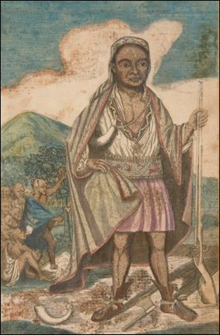
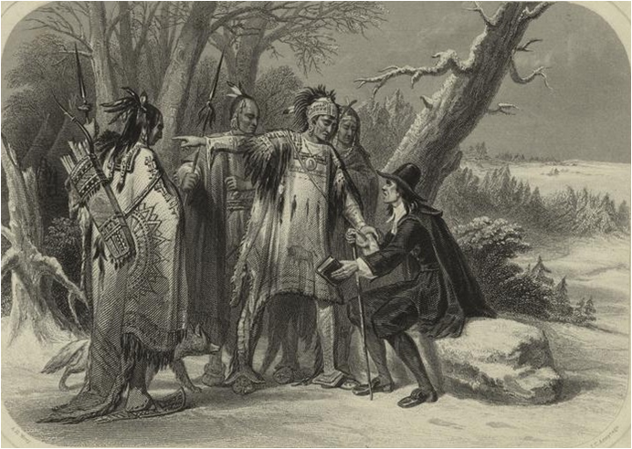
Squanto also became a translator/interpreter for the Pilgrims and introduced them to the local leader of the Wampanoag tribe, Massasoit.
This image is titled “Massasoit and His Warriors.” Massasoit (circa 1581-1661) was the sachem or leader of the Wampanoag Confederacy. He would negotiate a treaty guaranteeing the English their security in exchange for their alliance against the Narragansett Indians. This image was created circa 1857 and is courtesy of the Library of Congress.
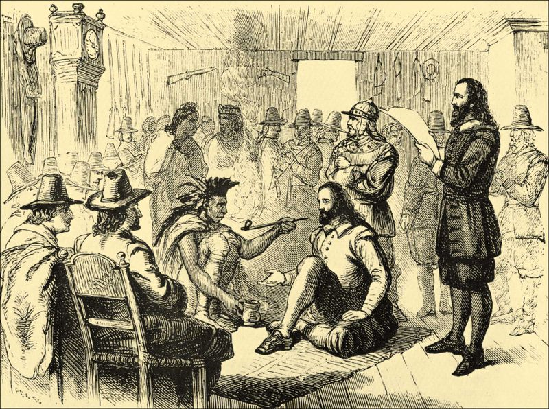
Massasoit and the Pilgrims negotiated a peace treaty which lasted for forty years.
Massasoit smoking a peace pipe with Governor John Carver in Plymouth on March 22, 1621. Massasoit’s trading with the Pilgrims during their early years helped to prevent the failure of the Plymouth Colony. He also warned the Pilgrims if other Native American tribes had plans to attack them. This image is courtesy of Wikimedia Commons.
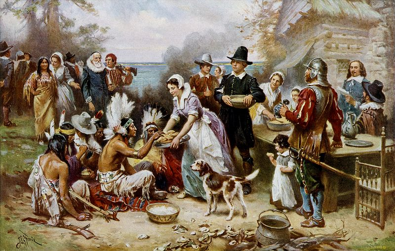
The Plymouth Colony celebrated a feast of Thanksgiving in the autumn of 1621 because of their good harvest.
“The First Thanksgiving” was painted circa 1912-1915 by Jean Leon Gerome Ferris (1863-1930). This ia a romanticized (idealized) version, and has some historical inaccuracies. The clothing worn by the Pilgrims is incorrect. The Wampanoags did not wear feathered war bonnets. The Wampanoags also would not have been sitting on the ground. This was not the first Thanksgiving in what is now the United States. The Spanish had a celebration of Thanksgiving in Florida in 1565. In Virginia, Thanksgiving services might have been routine as early as 1607. This image is courtesy of Wikimedia Commons.

Plymouth survived, and by the 1630s this settlement of the Pilgrims or Separatists had a population of around 2000 people.
Plimoth Plantation, a living history museum located in Plymouth, Massachusetts. This image was taken on September 18, 2002 by Nancy and is courtesy of Wikimedia Commons.

However, it would take the Puritans to make Massachusetts a more populous colony.
This image, titled “The Puritan” was created circa 1845. It is courtesy of the Library of Congress.
_________________________________________________________________________________
Jamestown
Section 2, Lesson 3
Previous Lesson: Steps Towards A Permanent English Colony
Next Lesson: The Plymouth, Massachusetts Colony
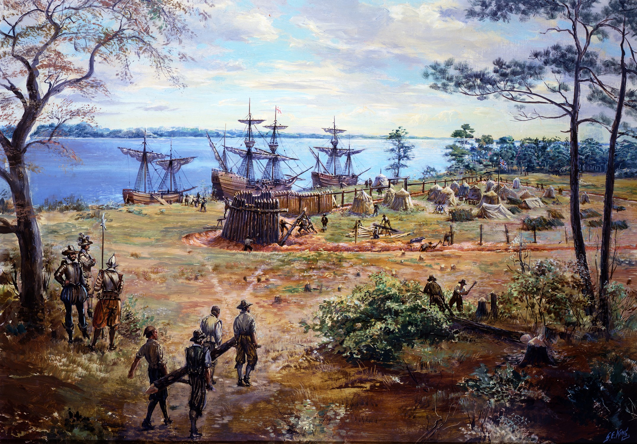
Jamestown
In the painting Construction of James Fort, colonists constuct the original palisaded walls of the Jamestown, Virginia three sided fort. This painting by Sidney King is courtesy of the National Park Service.

In 1606, a joint-stock company, the Virginia Company of London, …
Heading for the Broadside issued by The Virginia Company, London, 1615. This image is courtesy of the Virginia Historical Society.

…received a charter from King James I to establish a colony in North America.
“Charter for the Virginia Company of London, 1606.” This image is courtesy of the Library of Congress.
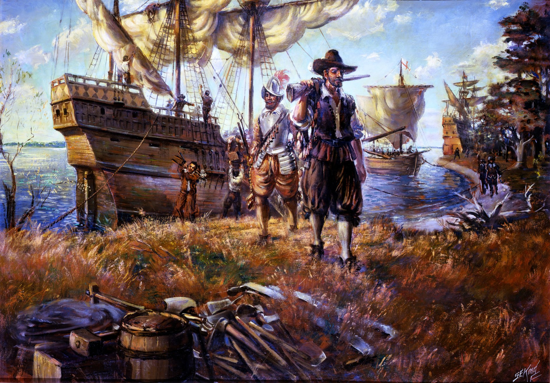
The English had three main reasons for establishing the colony:
English colonists land at Jamestown, Virginia. This painting by Sidney King is courtesy of the National Park Service.
First, to find gold.
This elongated gold nugget was found in Alaska. This photo was taken circa 2010 by Rob Lavinsky of iRocks.com and is courtesy of Wikimedia Commons.
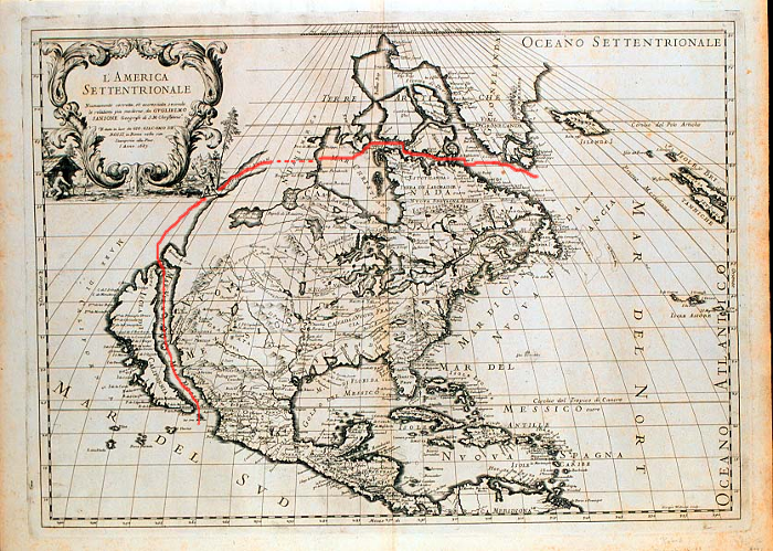
Second, find a water passage through America to Asia.
A map of the fictitious Strait of Anian that would take travelers by water from the Atlantic Ocean, across North America to the Pacific Ocean. This image by Guillaume Sanson was produced circa 1687 and is in the Yale Univeristy Library Map Collection. It is courtesy of Wikimedia Commons.

The third reason was to convert the natives to Protestant Christianity.
This painting depicts the ceremony in which Pocahontas, daughter of the influential Algonkian Chief Powhatan, was baptized and given the name Rebecca in an Anglican church. The ceremony took place in either 1613 or 1614 in the colony at Jamestown, Virginia. Pocahontas is thought to be the earliest native convert to Christianity in the English colonies. This ceremony and her subsequent marriage to John Rolfe helped to establish peaceful relations between the colonists and the local Native American groups. This painting by John Gadsby Chapman was created in 1839 and placed in the Rotunda of the United States Capitol in 1840. It is courtesy of the Architect of the Capitol.
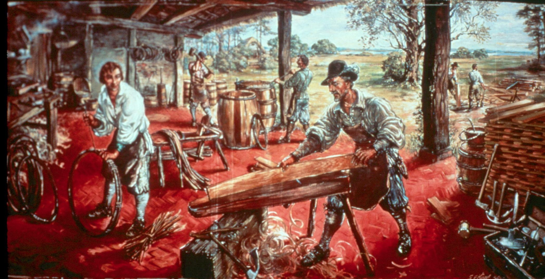
These overseas settlers were promised the same rights as Englishmen who lived in the mother country.
A cooper making barrels at his shop in Jamestown, Virginia. This painting by Sidney King is courtesy of the National Park Service.
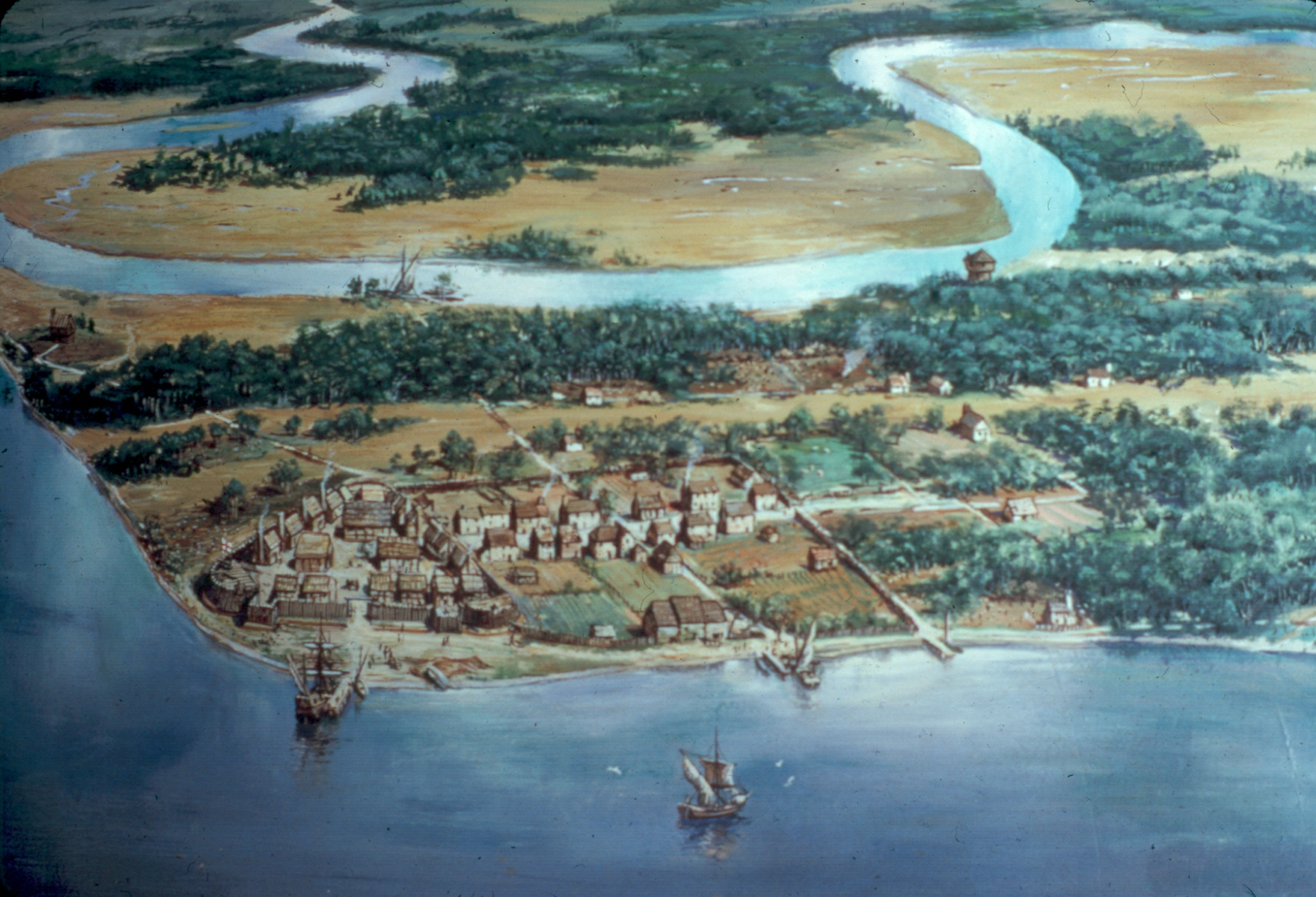
Their settlement, Jamestown, was located on the tree lined, but mosquito-infested banks of the James River, both named in honor of their king.
An aerial view of how Jamestown might have looked in the year 1614. This painting by Sidney King is courtesy of the National Park Service.

Although unhealthy, the Jamestown Island location on the water was considered to be a good spot to defend against the Indians who might attack by land…
Native Americans watch as the English colonists construct James Fort. This painting by Sidney King is courtesy of the National Park Service.

… and a feared attack of the Spanish by water.
A detail from the painting Construction of James Fort. The fort was constructed to defend the settlers from attacks by the Native Americans by land and the Spanish from the water. This image by Sidney King is courtesy of the National Park Service.
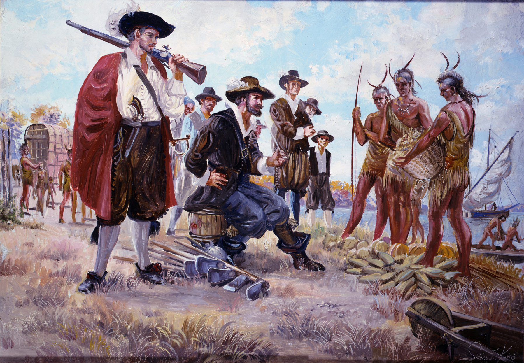
Hunting on the island was poor. The colonists depended on the local natives and the arrival of ships to supply them with food.
John Smith negotiating with the local Native Americans for food at Jamestown, Virginia. This image by Sidney King is courtesy of theNational Park Service.

The James River and the Chesapeake Bay contained many edible fish, but the colonists did not work enough at supplying their needs from the water.
When the English colonists first arrived in the Chesapeake Bay, they explored Cape Henry on April 26, 1607. They moved farther up the James River to found Jamestown on May 13, 1607. This painting by Sidney King of the First Landing at Cape Henry is courtesy of theNational Park Service.
The land surrounding Jamestown Island was ready to be ploughed and to grow corn, but the colonists planted their corn too late in the growing season.
This image of corn growing at Jamestown Settlement, a State Park, is courtesy of the College of William and Mary.
Orders from the Virginia Company, however, pressured the first colonists, some of whom were not the working poor, but “gentlemen”…
Sir Peter Saltonstall (not an English colonist) was in charge of the horses to King James I. This painting, circa 1610, is courtesy of Wikimedia Commons.
…and many of whom were not used to living in a wilderness…
The Native Americans in the Tidewater Virginia area were used to living in the wilderness, and would frequently check on the progress of the colonists at Jamestown. This painting by Sidney King is courtesy of the National Park Service.

… to search for gold, or be abandoned by the company.
Jamestown did not have very much, gold, especially compared to parts of Alaska where this 63.8 gram gold nugget was found. This image by Rob Lavinsky of iRocks.com is courtesy of Wikimedia Commons.Wikimedia Commons.
The adventurer John Smith took charge of the Jamestown settlement from 1608-1609.
This line engraving of John Smith appeared on a 1616 map of New England. The engraving was created by Simon de Passe (circa 1595-1647). The original is in the National Portrait Gallery in London, England. The image is courtesy of Wikimedia Commons.

His attempts at instilling discipline into the colonists appeared to work for a time.
Colonists were impressed with the deep, tall forests of Virginia. They would not only use the lumber for their own needs, they would export the lumber to England. This image by Sidney King is courtesy of the National Park Service.

His rules for the young “gentlemen” who did not feel that they needed to do physical labor included: “He who will not work shall not eat.”
Captain John Smith attempting to have the Jamestown “gentlemen” to work. This image is courtesy of the University of Maine at Farmington.
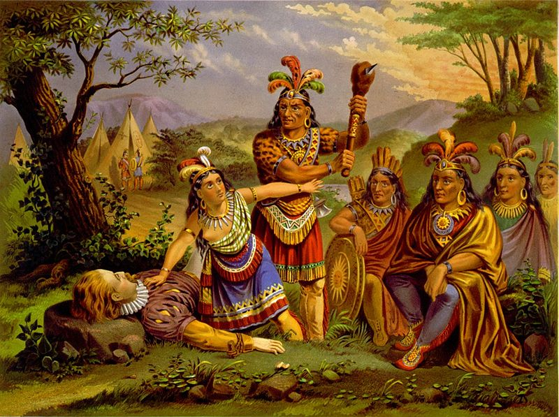
Smith would claim that the daughter of Chief Powhatan, Pocahontas, saved his life while he was bargaining with the Indians for supplies.
Artist depiction of Pocahontas saving the life of Captain John Smith. This image was created in 1870 by the New England Chromo Lithograph Company. It is courtesy of the Library of Congress.

Smith was wounded by an explosion/ignition of gunpowder in 1609 and went back to England to recover.
Although John Smith visited New England in 1614, he never returned to Virginia following his wound from the explosion/ignition of gunpowder. He died on June 21, 1631 and was buried in St. Sepulchre’s Church in London. This statue was created by William Couper and erected at Jamestown in 1909. This photograph is courtesy of Wikimedia Commons.

Although colonists had died in significant numbers from disease while Smith was in charge of Jamestown…
Mass grave at Jamestown National Historic Park. The graves are located beneath the foundations of one of the later capitol buildings. This photo by Sarah Stierch was taken on May 1, 2009 and is courtesy of Wikimedia Commons.

…the winter of 1609-1610 was an extremely difficult period. Hundreds of colonists died from not only disease, but from starvation.
The “Starving Time” at Jamestown was a period of forced starvation initiated by the Powhatan (local Native American) Confederacy to remove the English from Virginia. This painting by Sidney King is courtesy of the National Park Service.
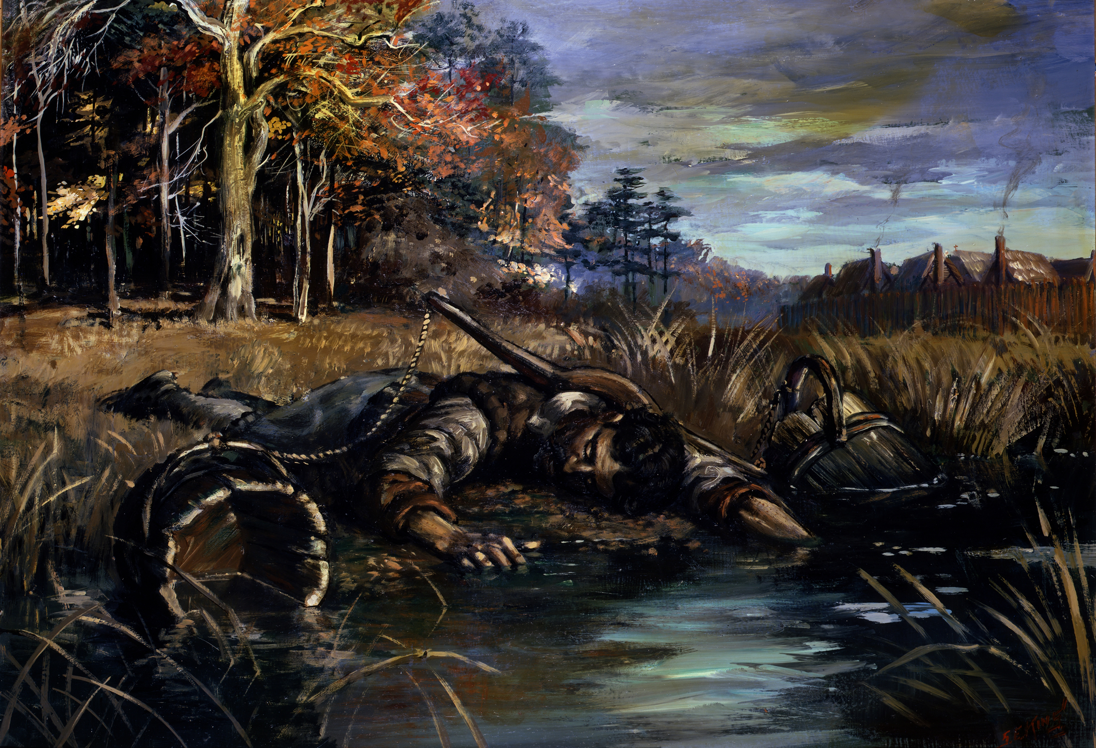
Of the 500 colonists that had settled in Jamestown, only 60 of them survived what became known as the “starving time.”
The first group of English colonists at Jamestown had never planned to grow all of their own food. Their plans depended on trade with the local Native Americans. The Indians (Powhatan Confederacy was to supply them with food between the arrivals of supply ships from England. When the Powhatans did not trade with the English for food the colonists starved. This painting by Sidney King is courtesy of theNational Park Service.

The survivors boarded ships, abandoned the colony and sailed towards the Chesapeake Bay. There a supply convoy with new supplies intercepted them and returned the colonists to Jamestown.
The convoy that met the colonists in Chesapeake Bay was led by a newly-appointed governor, Lord Delaware. He not only brought food, he also brought other colonists and a doctor. This painting by Sidney King is courtesy of the National Park Service.

Colonists also died in armed conflicts with the Indians who were upset about the amount of land the colonists were taking.
In 1622 Indians, who came into the colony pretending to sell the colonists provisions suddenly began attacking the English. 347 men, women and children of all ages were killed. This painting by Sidney King is courtesy of the National Park Service.
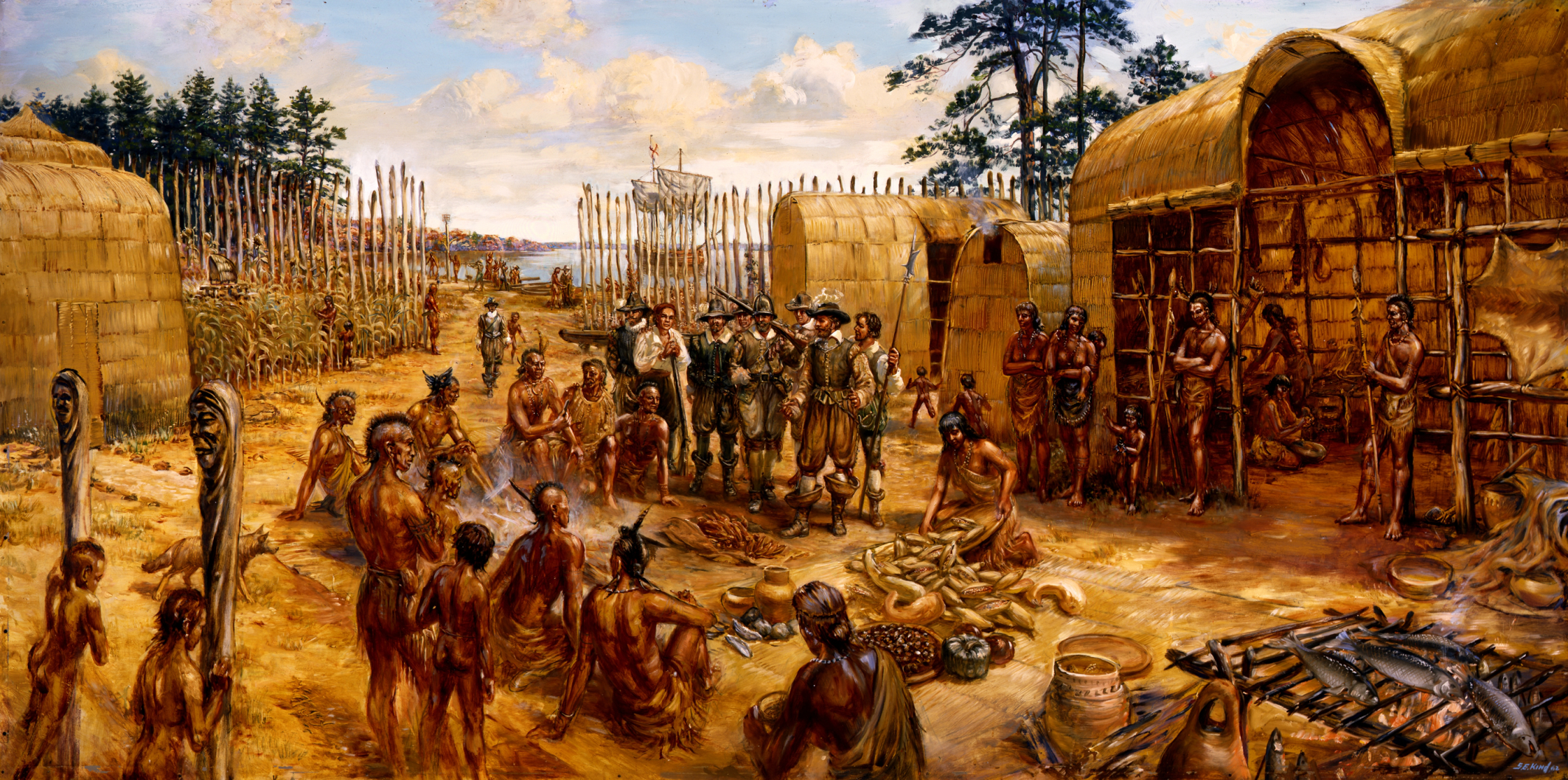
Pocahontas and other Native Americans were instrumental in supplying food to keep the colony from collapsing.
This painting, “Trading With the Indians” at Jamestown appears to show the English colonists have traveled by ship to a Native American village. They are discussing with the natives how they can trade for food. This painting by Sidney King is courtesy of the National Park Service.
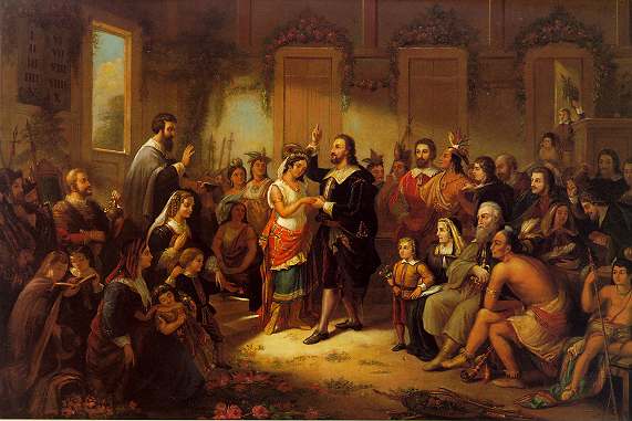
In 1614 Pocahontas married colonist John Rolfe.
John Rolfe’s first wife, who was English-born had died in Bermuda in 1609. The marriage of Pocahontas to John Rolfe created a climate of peace between the Jamestown colonists and Powhatan’s tribes for several years. This image by Henry Brueckner was created in 1855. It is titled, “The Marriage of Pocahontas” and is courtesy of Wikimedia Commons.
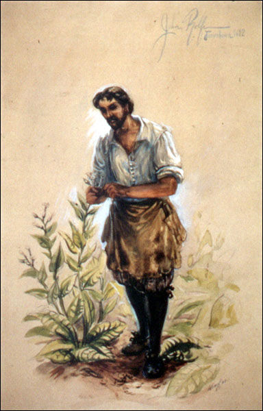
John Rolfe, with the help of the Native Americans developed and cured tobacco so that it would not have a bitter taste.
John Rolfe (circa 1585-1622 ) somehow brought to Jamestown tobacco seeds from a popular strain then being grown in Trinidad and South America. The Spanish, who controlled the tobacco market, had declared a penalty of death to anyone selling such seeds to somebody who was not Spanish. This image by Sidney King is courtesy of the National Park Service.
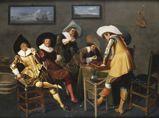
Tobacco use became wildly popular in England other other parts of Europe, and the colony was put on a firm economic foundation.
This image by Dirck Hals is titled Gentlemen Smoking and Playing Backgammon in an Interior. It is courtesy of Wikimedia Commons.

The growth of the tobacco industry in Virginia led to the establishment of large plantations and a need for many laborers.
Tobacco Production in Jamestown. This image by Sidney King is courtesy of the National Park Service.

In 1619 a British pirate ship flying a Dutch flag, appeared off the shore of Jamestown and sold the colonists approximately twenty Africans.
This image, titled Landing of Negroes at Jamestown from a Dutch Man-of-War, 1619 depicts the first 20 slaves to be brought to an English colony. This image was created in 1917 by Howard Pyle.

The records are unclear, but while it appears that these first Africans were treated as indentured servants…
An indentured servant was frequently a young, unskilled laborer contracted to work for an employer for a fixed period of time, typically three to seven years. In exchange for his work, the employer would provide his indentured servant : transportation, food, clothing, lodging, and other necessities during the term of his or her indenture. They were not paid wages. This image of indentured servants is courtesy of the College of William and Mary.
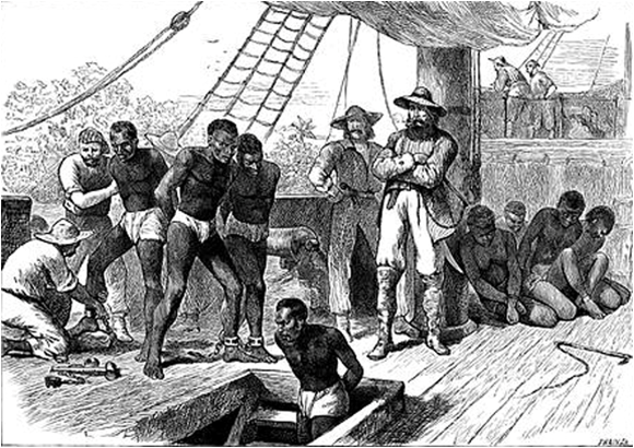
…this event marked the beginning of slavery in the English colonies.
On Board a Slave Ship. This image shows captives being brough on board a slave ship on the West Coast of Africa. This image was created circa 1880 and is courtesy of the University of Virginia.

In 1619, the same year that slavery was probably introduced to Virginia, representative self-government was also born at Jamestown.
This image of a desk in the chamber of the House of Burgesses in Jamestown, Virginia is courtesy of the National Park Service.
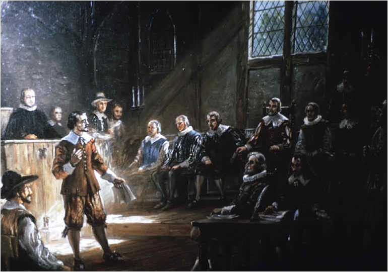
The London Company, allowing the colonists some local control, granted them a voice to run their own government.
The House of Burgesses first met in Jamestown, Virginia. This image by Sidney King is courtesy of the National Park Service.

The first assembly of the House of Burgesses, met for only five days because of an outbreak of malaria,…
This photgraph of a reenactment of the first meeting of the House of Burgesses at Jamestown, Virginia, is courtesy of the Commonwealth of Virginia.

…but it was the first of many town councils and colonial legislatures to emerge in America.
This picture of a reenactment of a meeting of the House of Burgesses in Williamsburg, Virginia is courtesy of the Colonial Williamsburg Foundation.

In 1620 another significant group sailed into Jamestown.
The stern of the replica of the Susan Constant, one of the first ships to sail to Jamestown in 1607. The replica, constructed in 1989, is located in Jamestown Settlement. This photo by Bmrbarre was taken on June 2, 2007 and is courtesy of Wikimedia Commons.

Approximately 100 women arrived,…
In 1620 approximately 90 single women joined the men of Jamestown. There had been women at Jamestown as early as 1608, but they were few in number. The arrival of the “Maids” gave the settlement some permanence. This painting by Sidney King titled Arrival of the Maids, is courtesy of the National Park Service.
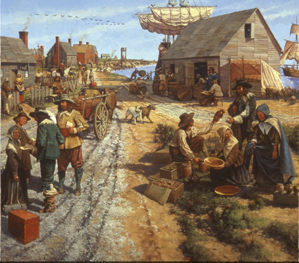
…and the colony’s population began to steadily grow.
By 1750 Jamestown was secure from attacks from the local Native Americans. The tobacco trade led to the steady growth of what was then the capital of Virginia. This painting by Keith Rocco is courtesy of the National Park Service.

Another North American English Colony was established in 1607 a few months after Jamestown.
This map of the Popham Colony and Fort St. George shows a star-shaped fort including diteches, ramparts, a storehouse, a chapel, and more than fifteen structures. This map by John Hunt was created circa 1607-1608 and is courtesy of Wikimedia Commons.

The Popham Colony and its Fort St. George was located in the present-day state of Maine.
This image is courtesy of the Archaeology Channel.

One of the primary reasons it was established was for shipbuilding.
This three cent stamp was issued by the United States Postal Service in 1957.
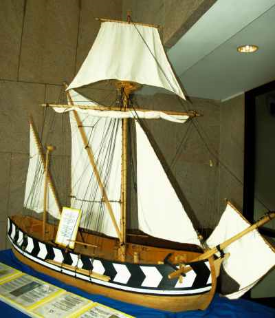
The colonists did construct a 30 ton ship which they named Virginia.
This model of the Virginia is on display at the Maine Maritime Museum. This image is courtesy of the Maine Maritime Museum.

It proved to be very seaworthy and was the first ship built by Europeans in North America.
Drawing of a small pinnace, which was the same type of ship as the Virginia, built by the Popham Colony. This image by an unknown artist is courtesy of Wikimedia Commons.
Popham was abandoned in 1608 when its leader, Raleigh Gilbert, son of Sir Humphrey Gilbert…
Raleigh Gilbert was the sixth son of Sir Humphrey Gilbert. Sir Humphrey Gilbert died after attempting to establish a colony in Newfoundland in 1583.

…learned he had inherited a large English estate and decided to go home. The rest of the colony chose to return with him.
The Mary and John was one of two ships to bring settlers to the Popham Colony in 1607. This image is courtesy of affordableAcadia.com.
_______________________________________________________________________________
Steps Towards A Permanent English Colony
Section 2, Lesson 2
Previous Lesson: English Colonial Failures in the 1500s
Next Lesson: Jamestown

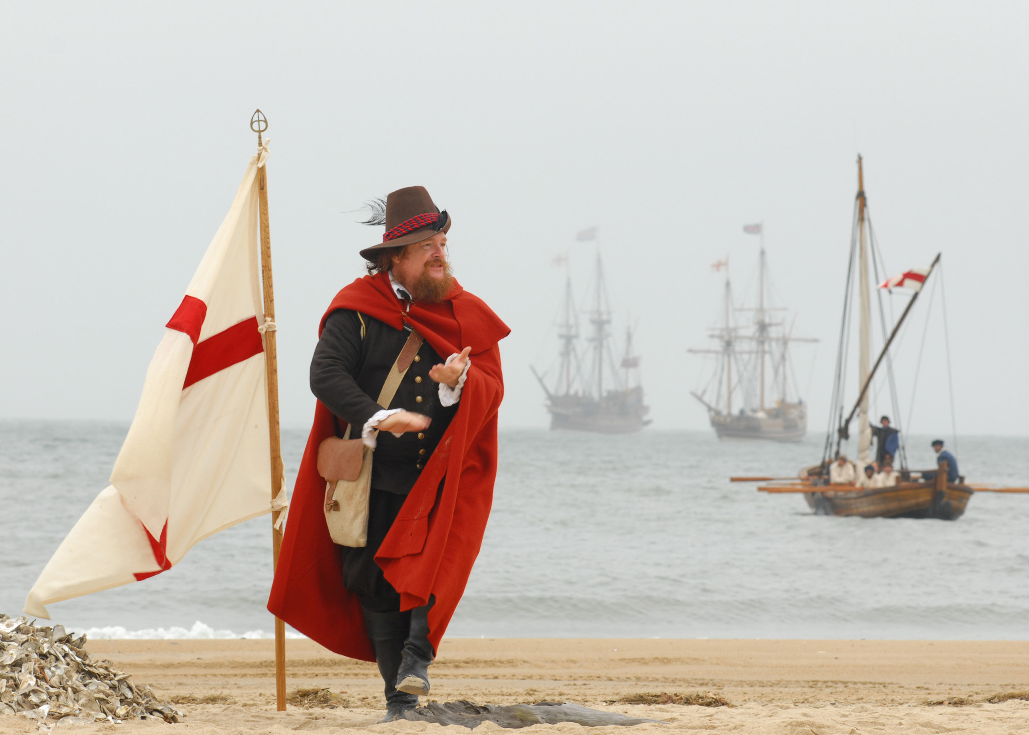
Steps Towards A Permanent English Colony
John Smith, played by Dennis Farmer, claims the Virginia Beach for England during a re-enactment ceremony of the 400th anniversary of the First Landing in the “New World.” Settlers from the ships the Godspeed, Discovery, and the Susan Constant landed on Virginia Beach and stayed four days before moving on to Jamestown. This photo, taken by Mass Communication Specialist Seaman Matthew Bookwalter on April 26, 2007 is courtesy of the United States Navy.

English “pirates” had become adept at plundering Spanish ships filled with gold from the Americas.
Spanish galleon firing its cannon at other ships. This painting by Cornelis Veerbeck (1590-1637) was produced circa the 1600s and is courtesy of Wikimedia Commons.

The English believed from their stealing of riches from Spanish ships that treasures were plentiful in America.
This image by Bernard Finegan Gribble (1872-1962) is titled Attack on a Spanish Treasure Ship and depicts an event circa 1620. It is courtesy of Ancestry.com.

By the 1600s, the English had multiple reasons to make another effort at colonizing North America.
This painting, titled The Departure of John and Sebastian Cabot from Bristol on their First Voyage of Discovery, 1497” was painted by Ernest Board in 1906. John Cabot (circa 1450-circa 1499) , and wearing black, was an Italian navigator who was born as Giovanni Caboto. His son, Sebastian Cabot (circa 1474-circa 1557) , and with his arms outstretched, may have accompanied his father, who sailed for England in 1497 to North America. There it is believed that they “rediscovered” Nova Scotia and Newfoundland. This image is in the collection of the Bristol City Museum and Art Gallery.
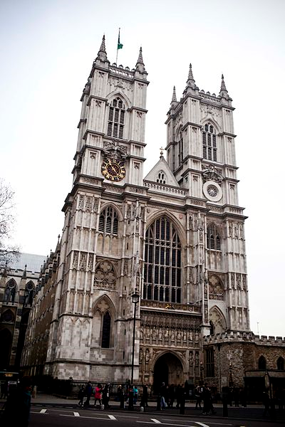
One reason was that England was the most powerful Protestant nation in the world…
The main entrance of Westminster Abbey in Westminster, London, England. It is the traditional place of coronation and burials for English and later British monarchs. This photograph was taken on February 20, 2011 by Jayrowdenphotography and is courtesy of Wikimedia Commons.

…and Spain was the most powerful Catholic Nation in the world.
The Primate Cathedral of Saint Mary of Toledo is a Roman Catholic cathedral in Toledo, Spain. It was began in 1226 and finished in 1493. This image by Michael Benutzer is courtesy of Wikimedia Commons.

England helped some countries rebel against their Catholic and specifically Spanish rulers.
Prince Maurits at the Battle of Nieuwpoort on July 2, 1600. This painting was created circa 1610-1640 by Pauwels van Hillegaert, and is located in the Rijksmuseum Amsterdam. This battle marked the beginning of the Thirty Years War in which the Protestant Dutch attempted to overthrow the rule of the Spanish Catholics. The end of the war led to an independent Dutch Republic. This painting is courtesy ofWikimedia Commons.
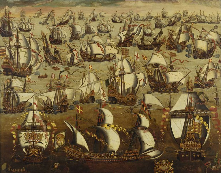
A second reason was that the English had defeated a large part of the Spanish Navy, (the Spanish Armada) in 1588.
English ships and the Spanish Armada. This painting by an unknown artist depicts the Battle of Gravelines in the English Channel near the Netherlands. The battle, which took place on August 8, 1588 was a decisive English victory. This image at the National Maritime Museum, Greenwich, London, is courtesy of Wikimedia Commons.

The Spanish, tired of the English attacking their ships, and of helping countries rebel against the Spanish, attempted to invade England.
This map shows that the Spanish Armada left the west coast of Spain and sailed into the English Channel where it attempted to anchor at Gravelines and ferry Spanish troops across the Channel to England. The British defeated the Spanish at Gravelines and harried the Spanish fleet up the east coast of England. Severe storms wrecked many Spanish ships on the coasts of Scotland and Ireland as the fleet attempted to sail south and back to Spain. Of the 130 ships that began the planned invasion, only 50 made it back to Spain. This map was created by the History Department for the United States Military Academy at West Point.

The large, slow, ships of the Spanish were defeated by the smaller, faster, and more numerous ships of the English.
English ships surround a ship from the Spanish Armada near the British fort at Tilbury at the mouth of the Thames River. This image, circa 1588, is courtesy of the British Library.

With the defeat of the Spanish Armada, England had the most powerful navy in the North Atlantic Ocean.
This image titled The Spanish Armada 1588 by William L. Wyllie (1851-1931) is courtesy of the Royal Navy.

She could now establish colonies in North America…
The British colonies in North America 1763-1775. The British colonies are colored pink, and are mostly along the Atlantic coast. This image was first published in William Robert Shepherd’s Historical Atlas in 1911. It is courtesy of Wikimedia Commons.

…bring supplies to the colonies…
A shipping scene showing trade between Jamestown, Virginia, and markets in England. This painting by Sidney King is courtesy of theNational Park Service.

… and protect the colonies.
Fort King George, located in southeastern Georgia, near Darien, was the southernmost fort built to protect the British Empire in the Americas from 1721-1727. The fort has been reconstructed and is operated by the state of Georgia for historical tours. This image, titled “A view from The Fort’s Northeastern sentry Box” was taken by Ftkgeo and is courtesy of Wikimedia Commons.
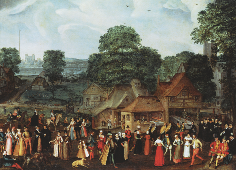
A third reason that England had thoughts of colonizing America was that she felt that she had more people than she needed.
A Marriage Feast at Bermondsey. This painting illustrates a panorama of society in the reign of Elizabeth I of England, who may be the lady being escorted from the church at the right. This painting by Joris Hoefnagel (1542-1600) was created circa 1569, and is courtesy ofWikimedia Commons.

In the late 1500s, many “lower class” people, and especially small farmers, were out of work.
This wood engraving shows an English shepherd/farmer during the Era of Queen Elizabeth (1558-1603). It was created circa the 1500s.

The feeling among some was that the land was overrun with the homeless and penniless…
Applicants for Admission to a Casual Ward. This image by Sir Samuel Luke Fildes (1844-1927) was painted in 1874. It shows the poor during Great Britain’s Industrial Revolution circa 1869. The painting is in the Royal Holloway College, Egham, Surrey, United Kingdom.

… who engaged in vulgar and indecent actions.
A woodcut from the 1500s shows a beggar being whipped as he is escorted through the streets of England during the time of Queen Elizabeth. The law ordered beggars to be “grievously whipped” for begging. A second offense could mean hanging. The beggar shown above is on his way to the gallows, pictured at the extreme left of this view. This image is courtesy of the University of North Carolina.

Perhaps these poor could be dumped on North America.
A woodcut from the 1500s showing a “gentleman” giving alms to a beggar. This image is courtesy of Wikimedia Commons.

A fourth reason that some felt it was time to become serious about colonization was that economic incentives were strong.
The Royal Exchange in the city of London, England was founded in 1565 to act as a center of commerce for the city. It was the site of numerous joint-stock company promotions in the 1700s and early 1800s. This image shows the second Royal Exchange Building on this site. The first opened in 1571 and was destroyed the the Great Fire of London in 1666. The building shown in this image opened in 1669, and was destroyed by fire in 1838. The third Royal Exchange Building opened in 1844 and is still in existence. The Royal Exchange ceased doing business in 1939. This work, by Thomas Bowles was completed circa 1751 and is courtesy of the Royal Exchange.

When Queen Elizabeth died in 1603, England did not have a permanent colony in the Americas.
The funeral of Elizabeth I of England in 1603. The casket of the queen is accompanied by mourners bearing the heraldic banners of her male ancestors’ coats of arms . They are placed side by side with the coats of arms of her female ancestors. This image is courtesy ofWikimedia Commons.

Queen Elizabeth’s successor, King James I, could not afford to send more to ships to America to begin a colony.
King James I (1566-1625) was King of Scots as James VI from July 24, 1567. On March 24, 1603 he also became King of England and Ireland as James I when he inerited the English and Irish crown and thereby united them with the Crown of the King of Scotland. This painting by Daniel Mytens (1590-1647) was produced circa 1621 and is courtesy of Wikimedia Commons.

A “middle class” had emerged consisting of merchants who could provide business leadership and wealth to establish colonies.
Sir Thomas Gresham (circa 1520-1579) was an English merchant and financier who assisted and advised the British royal family. He founded the Royal Exchange where merchants, tradesmen, and later stockholders could do business. This painting by an unknown artist of the Flemish school of art, was dated 1544 and is courtesy of Wikimedia Commons.

The joint-stock company, which was the ancestor to modern corporations, had been developed.
This painting shows the East India House, home to the East India Company, one of the first joint stock companies. The East India House was located on London’s Leadenhall Street. This image, by Thomas Hosmer Shepherd, was painted circa 1817 and is courtesy of Wikimedia Commons.
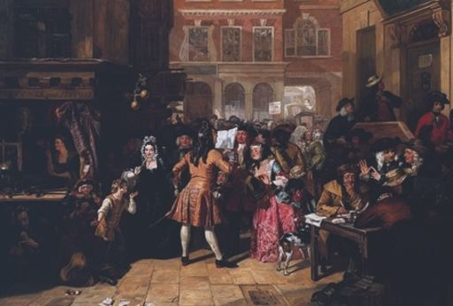
Joint-stock companies had many investors.
The South Sea Company was a British joint stock company that traded in South America (including slave trading) during the 1700s. Some companies made extravagant claims about its ventures to drive up the price of the stock. These types of companies were nicknamed “Bubbles.” When the truth of the company’s worth became known to the public, sometimes the “bubble would burst,” such as in this painting by Edward Matthew Ward, titled “The South Sea Bubble.” This image, in the Tate Gallery is courtesy of Wikimedia Commons.

Investors would buy a “share” or a piece of the company.
The seal of the London Company, also known as the Virginia Company of London. The Company was an English joint stock company established by royal charter by King James I in 1606 with the purpose of establishing colonial settlements in North America. It was responsible for establishing the Jamestown Settlement. In 1624 the company lost its charter, and Virginia became a royal colony. This image is courtesy of Wikimedia Commons.

They would then share the losses or profits that the company made.
One of the first joint stock companies was the Swedish company Stora which owned a mountain in which copper was availalble. This image shows a share giving the owner 1/8 of the Great Cooper Mine. The share is dated June 16, 1288. The original is in the Riksarkivet (National Archive) in Stockholm, Sweden. This image is courtesy of Wikimedia Commons.
_______________________________________________________________________________
English Colonial Failures in the 1500s
Section 2, Lesson 1
Previous Lesson: Spain’s New World Empire
Next Lesson: Steps Towards A Permanent English Colony

English Colonial Failures in the 1500s
A map of Chesapeake Bay (northern part of the map) to Cape Lookout, North Carolina by John White (1540-1593). White was an early English colonist and artist/map maker. In 1587 he became Governor of the Roanoke Island Colony. This map, created circa 1584, is courtesy of Wikimedia Commons.

In 1583, Sir Humphrey Gilbert attempted to place a colony on the coast of Newfoundland.
Sir Humphrey Gilbert (1539-1583) was an adventurer, explorer, member of Parliament, and a soldier. He was a pioneer of English colonization in Ireland and North America. This image, circa 1583 is courtesy of Wikimedia Commons.

Due to lack of supplies his settlement failed, and he lost his life when the ship that he took back to Europe sank in a storm.
Sir Humphrey Gilbert and five ships left England in June, 1583. Four of the vessels reached Newfoundland in July/August, 1583. When he sailed back, Gilbert decided to go near Nova Scotia where he lost his largest ship. When approximately 900 miles east of Newfoundland, on September 9, 1583, Gilbert drowned when his ship sank. This image is courtesy of Google Maps.
His half-brother, Sir Walter Raleigh, attempted to place an English colony in an area with a warmer climate than Newfoundland.
Sir Walter Raleigh (circa 1552-1618) and his son Walter in 1602. This image by an unknown artist was painted in 1602, and it is courtesy ofWikimedia Commons.

Queen Elizabeth allowed Sir Walter Raleigh to establish his colony…
“The settlement at Roanoke.” This image is from Pictorial History of America: From the Earliest Times to the Close of the Mexican War, Volume I by John Frost. The image was drawn circa 1853.

… in an area named Virginia by the “Virgin” Queen Elizabeth.
Elizabeth I of England (1533-1603). This painting by George Gower commemorates England’s defeat of the Spanish Armada. The scene depicting the Armada’s defeat is shown in the background of the portrait. Elizabeth’s international power is reflected by her hand resting on the globe. This image, produced circa 1588 , is courtesy of Wikimedia Commons.

Although called Virginia, the settlement at Roanoke Island was located in what is now the State of North Carolina.
Roanoke Island is located in the Outer Banks section of North Carolina. The Atlantic Ocean is on the far right. Roanoke Island is located between what is now called Roanoke Sound and Croatan Sound. This image is courtesy of Google Maps.
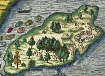
The first settlement in 1584 ran out of food in less than a year.
Detail of Roanoke Island from a map in Thomas Hariot’s (1560-1621) A Briefe and True Report of the New Found Land of Virginia…. The English colony was
established on the northern section of the island. The map was illustrated circa 1585-1593 by John White (1540-1593) .
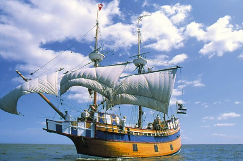
No comments:
Post a Comment